CHC Navigation
CHC Navigation is expanding its reach throughout Europe and the world, with more dealers and custome...

CHC Navigation (CHCNAV) is a publicly listed company creating innovative GNSS navigation and positioning solutions. With a global presence across the world, including distributors in over 120 countries and more than 1,500 employees, CHC Navigation is today recognized as one of the fastest-growing companies in geomatics technologies.
CHC Navigation develops advanced geospatial technologies and provides a wide range of state-of-the-art solutions for land surveying, construction, GIS, hydrography and bathymetric survey, deformation monitoring, precision farming and 3D mobile mapping for mass data acquisition.
The i73 GNSS is a versatile pocket-sized IMU-RTK GNSS rover combining best-in-class performances and integrated inertial module to automatically compensate for pole tilt. The i90 GNSS receiver offers integrated IMU-RTK technology to provide a robust and accurate positioning, in any circumstances. Its automatic pole-tilt compensation boosts survey and stakeout speed by up to 30%. The P5E GNSS reference receiver guarantees outstanding performances for all geodetic and scientific applications.
The CHCNAV slogan perfectly summarizes the way our GNSS Positioning and integrated Navigation Solutions are designed to dramatically improve productivity and provide an outstanding return on investment for our customers and business partners.
CHC Navigation invites potential dealers to apply for cooperation. Our dealers have a choice to represent one or more products based on the potential customers’ needs in their region. We communicate openly and frequently, build mutual trust, and help generate larger gains for every dealer. For details, please fill out the form on our website https://chcnav.com/contact-us/become-a-dealer


CHC Navigation is expanding its reach throughout Europe and the world, with more dealers and custome...

Surveying and mapping are an important foundation for the development of a national economy. An accu...

The latest GNSS technologies from CHCNAV have been used in combination with vocational training on t...

With the rapid development of civil construction and the increasing demand for electricity in recent...

Following its emergence more than a decade ago, digital twin technology has developed to become a co...

Find detailed technical information about the i90 IMU-RTK GNSS and view brochures, videos and case studies and compare it with other similar products

Find detailed technical information about the i83 IMU-RTK GNSS and view brochures, videos and case studies and compare it with other similar products

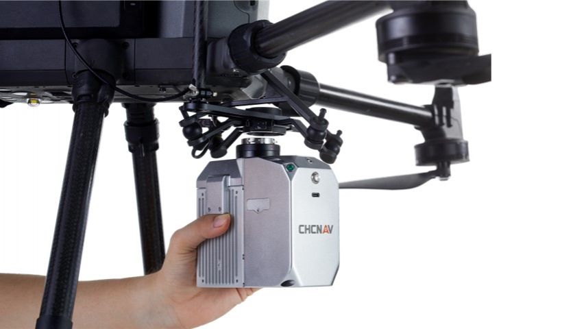
Find detailed technical information about the ALPHA3D and view brochures, videos and case studies and compare it with other similar products

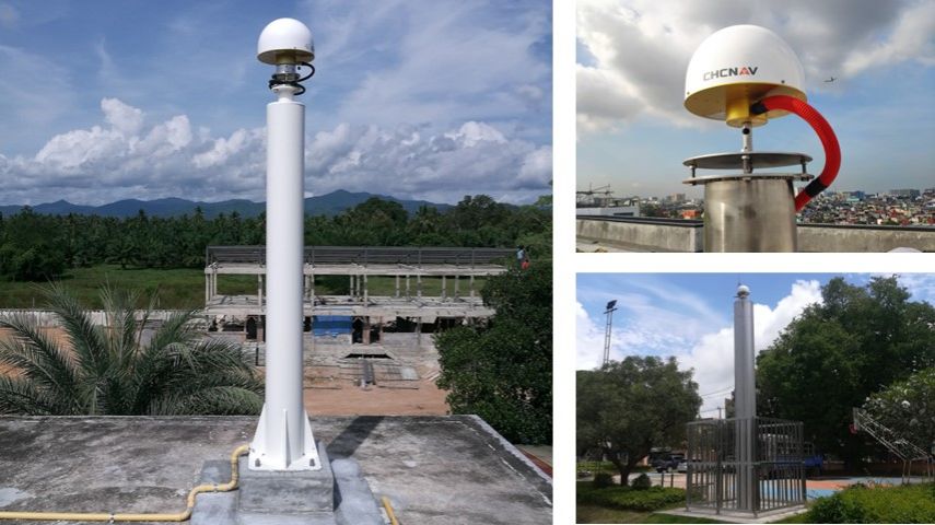
Find detailed technical information about the CGI-610 and view brochures, videos and case studies and compare it with other similar products

Find detailed technical information about the P330 PRO VTOL Drone and view brochures, videos and case studies and compare it with other similar products
This site uses cookies. By continuing to use this website, you agree to our Cookies Policy. Agree