

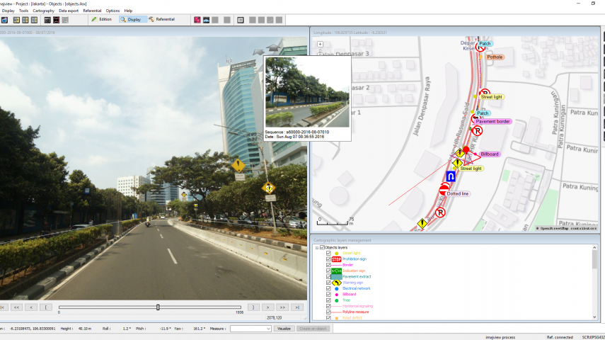
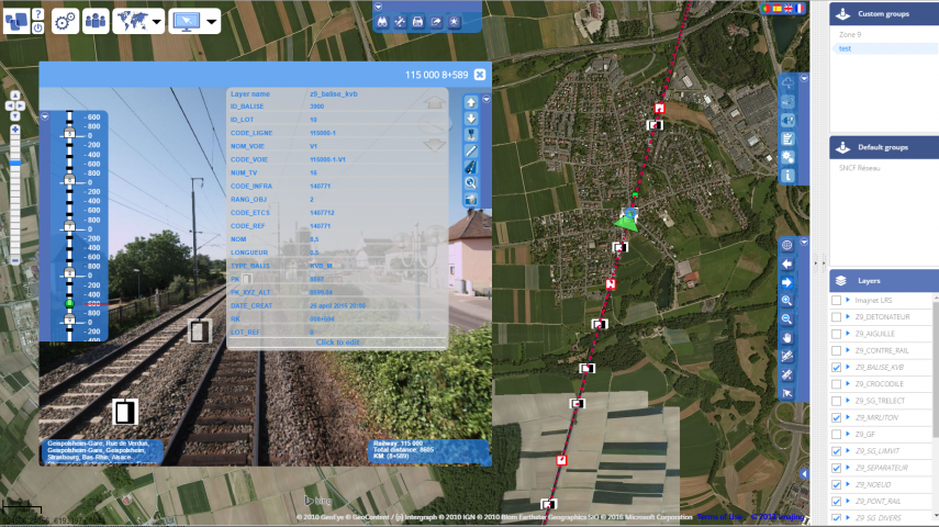
Imajing is a mobile mapping provider created in 2008 to answer the needs of transportation infrastructures managers for roadways, railways, waterways and utilities condition assessment, asset management, asset inventory and monitoring.
Based in France, the Imajing team is composed of experts in geo-positioning, navigation, image processing, mapping and GIS.
Our technology is based on a revolutionary concept for mobile mapping systems. The company has chosen to size its products to give flexibility and ease-of-use to its clients.
In doing so, today imajing is well-known for providing a powerful and integrated mobile mapping tool chain which merges field reality with geographical data, for transportation infrastructures mapping, surveying and management.
Imajing is always willing to partner with local organizations in countries where its products are not represented yet. A trustfull relationship is essential for a profitable collaboration.
When committing with a company which has chosen to represent Imajing technologies, we aim at giving all the marketing and communication supports. The necessary tools, pieces of demos and training are provided by Imajing expert to enable our partners to perform valuable demonstrations to prospects and clients.

This site uses cookies. By continuing to use this website, you agree to our Cookies Policy. Agree