Elevating knowledge: read our in-depth features
This innovative approach to measuring 3D urban growth integrates Lidar processing with machine learning. It takes account of the specific needs of urban planners, is less complicated to run and addres...

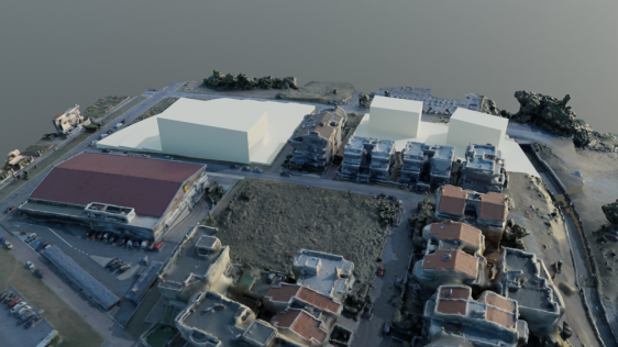
Hannes Taubenböck and his team at the German Aerospace Center (DLR) are using very high-resolution (VHR) satellite imagery, supplied by European Space Imaging, combined with auxiliary surveys to deve...

There are not so many people around thinking about the area they dwell in. I mean really thinking about efficiency, economy, aesthetics, and standards. We rarely even raise our heads up and turn our e...

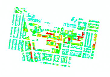
The Turkish city of Istanbul is developing a 3D city model mainly aimed at urban planning. The data sources used so far include airborne Lidar, aerial images and 2D maps containing footprints of build...
The Turkish city of Istanbul is developing a 3D city model mainly aimed at urban planning. The data sources used so far include airborne Lidar, aerial images and 2D maps containing footprints of build...
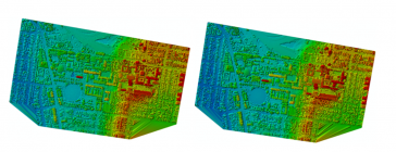
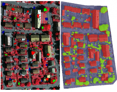
Automated measurement of the third dimension of urban growth is a crucial requirement for future urban planning and monitoring. Airborne Lidar is increasingly being used to produce regular time-based ...

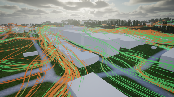
Dublin City University (DCU) has partnered with Bentley Systems to spearhead the creation of an advanced digital twin of its campus as a pivotal element of its Smart DCU initiative. This collaborative...

Our weekly newsletter is an easy way to stay updated with our latest articles, news, and magazines. It's the easiest way to stay current with the industry.
Subscribe to our newsletter(s)This site uses cookies. By continuing to use this website, you agree to our Cookies Policy. Agree