Found 975 results
Sort by

Trimble Launches US$200 Million Venture Fund

Trimble has announced the creation of Trimble Ventures, a venture fund focused on investing in early and growth-stage innovative companies that align with Trimble's mission of transforming work in the agriculture, construction, geospatial and...

Read more

Laser Scanning Solutions for Glacier Exploration

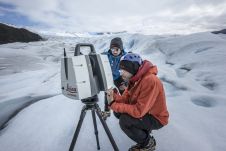
Technological advancements have brought increasingly compact instruments, enabling more rapid data acquisition and powerful processing abilities even in extreme field environments like glaciers, according to Tommaso Santagata, surveyor and speleologist from VIGEA – Virtual Geographic Agency and part of the Patagonia team. “Look deep into nature, and then you will understand everything better,” Albert Einstein is quoted as saying. And indeed, looking deep into glaciers can help us understand climate change. But...

Read more

Mission Possible, With the Right Tools

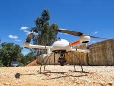
The mission: capturing 21 quarries in 60 days. Squeezed into that timeframe were planning and performing the UAV photogrammetry flights, editing the RAW images, processing the data, extracting the topography using Virtual Surveyor, and production of the orthophotos, Digital Surface Model (DSM), Digital Terrain Model (DTM) and contour maps for each site. The main client, a government institute, needed highly precise and reliable 3D models and maps fast, as well as data their engineers could work with in a CAD environment. “There was a lot of pressure because of the short timeline”, said Nuno Santos, owner and CEO of Aerisurvey, a Mangualde, Portugal-based company specialized in high-precision UAV surveying. Mapping 21 Quarries in 60 Days The mission was to capture 21 quarries in 60 days. Squeezed into that timeframe were planning and performing the UAV photogrammetry flights, editing the...


Read more