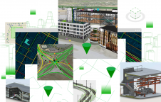
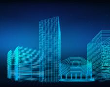
ArcGIS GeoBIM Brings Spatial Context to AEC Operations
Esri has released ArcGIS GeoBIM to expand the ability for BIM teams to benefit from GIS. This is the latest step in the partnership between the global leader in location...
Esri has released ArcGIS GeoBIM to expand the ability for BIM teams to benefit from GIS. This is the latest step in the partnership between the global leader in location...
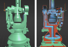
A recent project has celebrated 100 years of geodetic and photogrammetric innovation by 3D-digitizing an iconic WILD T2 theodolite from the 1927 series. An app has also been developed for...
A new basemap combines 360-degree aerial imagery and precise location data, providing an immersive new way to view and experience the built world from every cardinal direction. Basemap imagery offerings...

Crew-B – a trio of young entrepreneurs – recently discovered the best tool to scan multiple sites in a single day. Their client, a European leader in the fitness market,...
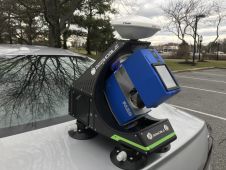
BAM Infra recorded 3D road models using a Faro terrestrial laser scanner with the innovative BeeMobile mobile mapping system at various locations across the Netherlands in 2020. BAM Infra is part of...

Despite having to improvise, this year’s pioneering digital edition of Intergeo has received a lot of positive feedback. It became the international geospatial industry’s first-ever online-only event after the COVID-19...
There is a general acknowledgement in the scanning and mapping industry that, compared to terrestrial laser scanners (TLS), mobile mapping systems significantly increase scanning speed and point cloud coverage. This is especially true for building interiors and equipment. This results in reduced time on site, which in turn lowers the cost of scanning for the service provider. There is a general acknowledgement in the scanning and mapping industry that, compared to terrestrial laser scanners (TLS), mobile mapping systems significantly increase scanning speed and point cloud coverage. This...

Direct exchange, lively discussions, lots of information and great entertainment. High acceptance of the digital offer in pandemic times by the geo-community. Prof Dr Hansjörg Kutterer from the organizer DVW...
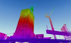
When it comes to 3D modelling for construction, what are the advantages and disadvantages of photogrammetry versus Lidar in terms of accuracy, complexity and cost? Breaking away from laser measurement...
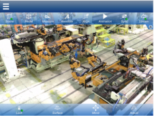
Arvizio has introduced new capabilities to its enterprise XR platform with GPU-accelerated hybrid rendering to stream massive 3D models and Lidar scans to multiple participants on mobile AR devices. The...
This site uses cookies. By continuing to use this website, you agree to our Cookies Policy. Agree