Drawing the Right Conclusions from Open Source and Open Data
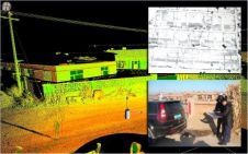
The recent Geo Forum lecture shone the spotlight on open source software and data. Is there an opportunity here for Geomatics, wonders Chris Preston, chair of the Geomatics Professional Group...