Leica SpiderWeb 2.0
Leica SpiderWeb version 2.0 has been extended with additional features and services that improve the usability and efficiency for both service users and service providers. Leica SpiderWeb is easy to...
Leica SpiderWeb version 2.0 has been extended with additional features and services that improve the usability and efficiency for both service users and service providers. Leica SpiderWeb is easy to...
Version 2.0 of Leica GeoMoS has been released. This is a solution for multi-sensor structural monitoring using a range of high precision geodetic instruments from Leica Geosystems and third-party sensors....
DM Solutions Group (Canada) has made available Chameleon version 2.0, an Open Source software for creating customisable Web mapping applications. This latest version provides the flexibility to utilise both remote...
GTC 2022 | Geo-intelligence, Building Multi-dimensional Foundation

Ordnance Survey International has been appointed by the World Bank to help build up geospatial data expertise in Tanzania. The mapping agency will do this through capacity building in data collection,...
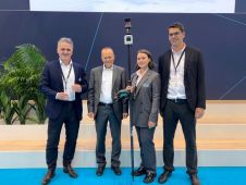
The Leica AP20 AutoPole received the prestigious Wichmann Innovations Award at this year’s Intergeo in Essen, Germany. The award honours new technology that stands out for innovation, user-friendliness and practicality....

Planet was founded with the mission to image the Earth every day and make change visible, accessible, and actionable. Over the past decade with our customers, Planet has revolutionized the...

The capacity to establish, maintain and sustain land administration systems varies from one country to another. In some developed countries the capacity is well established and enables maintenance and further...

The German Federal Agency for Cartography and Geodesy (BKG) is creating a digital twin of the whole of Germany that can be used to simulate various future scenarios in order...
This site uses cookies. By continuing to use this website, you agree to our Cookies Policy. Agree