Five Decades of Mapping the Moon
This year, NASA is celebrating the 50th anniversary of the first crewed mission – Apollo 11 – landing on the moon. Besides that, this September it will be 60 years...

This year, NASA is celebrating the 50th anniversary of the first crewed mission – Apollo 11 – landing on the moon. Besides that, this September it will be 60 years...
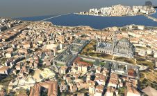
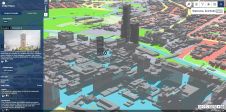
The Turkish city of Istanbul is developing a 3D city model mainly aimed at urban planning. The data sources used so far include airborne Lidar, aerial images and 2D maps...
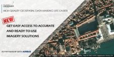
PlanetObserver, provider of value-added geospatial data for civil and military solutions, has announced a partnership with Airbus Defence and Space, a aeronautics, space and related services company, to distribute their...
PlanetObserver, provider of value-added geospatial data for civil and military solutions, has announced a new partnership with Airbus Defence and Space, a global leader in aeronautics, space and related services,...

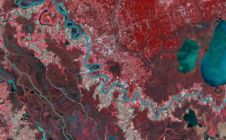
Airbus Defence and Space and Hisdesat Servicios Estratégicos have generated the first joint TerraSAR-X / PAZ Radar Interferogram. This milestone demonstrates the missions’ capacity for cross-sensor interferometry, which is extremely...
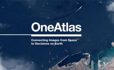
Airbus Defence and Space has released a new version of the OneAtlas platform, its collaborative environment to access premium imagery, perform large-scale image processing, extract industry-specific insights and benefit from...
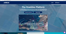
Airbus Defence and Space has released a brand new version of The OneAtlas Platform, its collaborative environment to easily access premium imagery, perform large-scale image processing, extract industry-specific insights and...
Airbus Defence and Space is now offering new capabilities for wide area monitoring through the DMC Constellation, bringing increased resolution (12 to 24m) and extra spectral bands, including Red-Edge, Blue,...
Reality 3D models, Lidar points clouds, superhigh-resolution aerial imagery and artificial intelligence from aerial imagery… these are just a few of the products derived from aerial mapping that the GIS...
The Turkish city of Istanbul is developing a 3D city model mainly aimed at urban planning. The data sources used so far include airborne Lidar, aerial images and 2D maps...
This site uses cookies. By continuing to use this website, you agree to our Cookies Policy. Agree