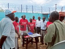
GAF to Assist GMES & Africa Support Programme
GAF AG has announced the award of the “GMES and Africa Support Programme Technical Assistance Team” service contract by the European Commission. The services consist of the provision of support...

GAF AG has announced the award of the “GMES and Africa Support Programme Technical Assistance Team” service contract by the European Commission. The services consist of the provision of support...

GAF’s geoinformation experts have signed up Planet, one of the global leading providers of high frequent Earth Observation data to extend GAF’s multisource satellite data and service portfolio for a...
GAF, Germany, has successfully accomplished the extensive fieldwork programme in its Darfur Natural Resources Mapping and Database Project carried out for the Darfur Land Commission (DLC). This is the largest,...
Astrium Services’ geoinformation experts have signed a distribution agreement with GAF AG, one of Europe’s leading providers of Earth observation and geoinformation solutions, to become a channel partner for its...
With the ability to image up to 4 Million km² of the earth's surface daily, RapidEye's constellation of five satellites will download an enormous amount of data every day. To...
ViewTec AG (Switzerland) and Intermap Technologies Corp. (CO, USA) have entered a strategic business partnership to provide TerrainView-Globe 3D with premium elevation models, based on Intermap's geospatial core products and...
GAF AG has won an international tendering process issued by the German Federal Agency for Cartography and Geodesy (BKG) for the provision of remote sensing data. The framework agreement includes...

The European Environment Agency (EEA) has contracted GAF AG and its international partners to implement the update of the Copernicus High Resolution Layers (HRLs) Imperviousness, Forest, Grassland, Water/Wetness and Small...

The Ministry of Natural Resources, Energy and Mining in Malawi is establishing a Geological Data Management Information System (GDMIS). GAF has been awarded a contract to design and implement the...

As part of the Copernicus Land Monitoring Service’s local component, a European consortium headed by GAF AG is conducting a detailed assessment of land cover/land use changes at more than...
This site uses cookies. By continuing to use this website, you agree to our Cookies Policy. Agree