The IAG and FIG Relationship
The link between these two geospatial ‘sister’ organisations is a fundamental one that goes back many years. Because geodesy has always provided the foundation for surveying and mapping, many geodesists...

The link between these two geospatial ‘sister’ organisations is a fundamental one that goes back many years. Because geodesy has always provided the foundation for surveying and mapping, many geodesists...
3D Laser Mapping, UK, has announced a programme of educational workshops, beginning in Malaysia at the end of March 2012. Designed to educate potential users of laser scanned data the...
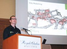
The first event in a series of educational workshops has been hailed as a success by organisers 3D Laser Mapping (UK). Attracting more than 50 practitioners and professionals from public...

The FIG General Assembly 2012 was held during the recent Working Week in Rome, Italy. In total, 71 different member associations were present at the two sessions of the General...
The US Topo map project, as part of the U.S. Geological Survey national map series, recently released new maps for Wyoming and South Dakota. The more than 3,230 revised digital...
The full feature is online at http://member.gim-international.com/. Please subscribe for free using the Subscribe button in the left hand column. South Korea’s recent historical and economic development has come to...

Around 450 delegates from 45 countries gathered for the ELMF at the Salzburg Congress Centre, where presentations were delivered by the world’s leading Lidar experts. Focusing on the use of...
The Netherlands Institute of Navigation (NIN) is inviting navigation professionals to attend the annual European Navigation Conference, to be held from 14 to 17 April 2014 in the World Trade...

What is the impact of the US sequestration on the geomatics sector? Can we expect to see more negative effects in the future? GIM International has asked around in the...

COVER STORY The welcome delegates received at the FIG Abuja Working Week is clearly shown in this dancer’s face. You can read more in John Brock’s report (page 14) and...
This site uses cookies. By continuing to use this website, you agree to our Cookies Policy. Agree