News from The Survey Association
In this article we are featuring news from The Survey Association (TSA) and this will be followed up by regular columns. The TSA conference was held in November and we...

In this article we are featuring news from The Survey Association (TSA) and this will be followed up by regular columns. The TSA conference was held in November and we...

To explore interest in developing a pan-European gazetteer service, the Joint Research Centre of the European Commission (JRC) and EuroGeographics, the member organisation for European National Mapping and Cadastral Agencies,...

Spatial information plays a key role in disaster management. Upon occurrence of an emergency situation, crisis management actors need specialised maps to give them a clear idea of the emergency,...

On the geoportal Bank of Spatial Data, the maps of the Belgorod and Bryansk regions, created using OpenStreetMap data, were updated. Source data obtained from the GIS-Lab website are complemented...
After his education in hydrography, Nicolàs de Hilster was employed by Osiris from 1989 to 1996. He then moved to the Survey Department of Rijkswaterstaat (GAM-Department). In 2000, Nicolàs became...

Huibert-Jan Lekkerkerk is a contributing editor, freelance hydrographic consultant and author of other publications on GNSS and hydrography and principal lecturer in Hydrography at Skilltrade (Cat B) and the MIWB...
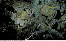
Every June, the first and second-year students of ocean technology (hydrography) at the Maritime Institute Willem Barentsz (MIWB) do a two-week field project around the institute’s campus, located on the...

Wim van Wegen is head of content at GIM International and Hydro International. In his role, he is responsible for the print and online publications of one of the world’s leading...
Rear Admiral of the ltalian Navy (ITN) retired, Giuseppe Angrisano was commissioned in 1957 and specialised in Hydrography in 1965. He commanded various ITN vessels including the oceanographic shipMagnaghi. He...

This issue of GIM International has a special focus on unmanned aerial vehicles (UAVs), which have become essential tools for the surveying profession. Three separate articles zoom in on three...
This site uses cookies. By continuing to use this website, you agree to our Cookies Policy. Agree