Leica MobileMatriX v2.0
Leica Geosystems (Swizerland) has released Leica MobileMatriX version 2.0; a multi-sensors GIS solution for capturing GIS data directly in the field. The new version 2.0 now supports Leica ATX1230 GG...
Leica Geosystems (Swizerland) has released Leica MobileMatriX version 2.0; a multi-sensors GIS solution for capturing GIS data directly in the field. The new version 2.0 now supports Leica ATX1230 GG...
Leica SpiderWeb version 2.0 has been extended with additional features and services that improve the usability and efficiency for both service users and service providers. Leica SpiderWeb is easy to...
Version 2.0 of Leica GeoMoS has been released. This is a solution for multi-sensor structural monitoring using a range of high precision geodetic instruments from Leica Geosystems and third-party sensors....
DM Solutions Group (Canada) has made available Chameleon version 2.0, an Open Source software for creating customisable Web mapping applications. This latest version provides the flexibility to utilise both remote...
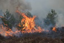
The number of wildfires has increased dramatically in recent years due to diminishing forest health caused by the drastically changing climate across the world. Longer dry-weather periods and pressure from a variety of pests and diseases, e.g. bark beetles, are affecting the large forest areas in Northern Europe. In addition to financial losses, these impacts are resulting in lower carbon accumulation and vast ecological changes. The number of wildfires has increased dramatically in recent years due to diminishing forest health caused by the drastically changing climate across the world. Longer dry-weather periods and pressure from...
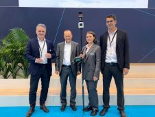
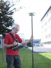
The Leica AP20 AutoPole received the prestigious Wichmann Innovations Award at this year’s Intergeo in Essen, Germany. The award honours new technology that stands out for innovation, user-friendliness and practicality....
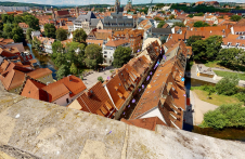
Lidar-powered Matterport technology was employed to create a 3D digital twin of the most famous inhabited bridge globally, the Krämerbrücke, situated in the city of Erfurt, Thuringia, Germany. The Krämerbrücke...
Esri is to take part in several side events at the United Nations Conference on Sustainable Development (Rio+20). The conference will be held from 20 to 22 June 2012 in...
LizardTech, USA, celebrates its 20th anniversary this year. As part of the celebrations, and to reflect on how it all started with the introduction of MrSID two decades ago, the...
VisionMap’s A3 ground processing system version 2.0 is now released. The ground processing system, together with A3 camera improvements now feature better radiometry, higher resolution DSM processing, as well as...
This site uses cookies. By continuing to use this website, you agree to our Cookies Policy. Agree