Digital Oblique Aerial Cameras (2)
In recent years, aerial photogrammetry has increasingly been using camera systems which capture nadir and oblique images at the same time. The number of oblique systems on offer in the...

In recent years, aerial photogrammetry has increasingly been using camera systems which capture nadir and oblique images at the same time. The number of oblique systems on offer in the...
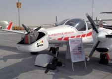
The Austrian company Airborne Technologies is specialised in two business fields: sensor integration/aircraft modification, and data acquisition/data processing. With its own fleet of multi-mission aircraft and data processing systems, Airborne...
South African GeoM (formerly Geomatica) has invested in a navigation system designed to improve the locational accuracy and reliability of aerial survey data. The purchase of a 5th-generation Computer Controlled...
Icaros, a provider of advanced aerial remote sensing and 3D visualisation solutions, has introduced the Icaros Measurement Tool (IMT), a photogrammetric visualisation application based on ArcGIS technologies, at the 2014...
With the successful integration of SPECIM's AisaFENIX, a full spectrum imager, on the DA42 MPP special mission aeroplane, Diamond Aircraft Industries has added first-rate hyperspectral detection capabilities to its range...
Icaros, a company specialised in advanced aerial remote sensing and 3D visualisation solutions, will demonstrate the Icaros Measurement Tool (IMT) at Intergeo in Berlin. Designed for use with oblique aerial...

From 5 to 8 May, RIEGL is organising its international user conference, being held at two different locations: Hong Kong and Guangzhou, China. The company stated presentation slots and seats...

3D Laser Mapping are turning heads this week at Intergeo, as the new ‘StreetMapperIV’ mobile mapping system is launched. StreetMapper first came onto the market in 2004, driven by client...
RIEGL attended and presented at 3D Laser Mapping’s User Conference 'Digital Information in 3D' at the Prince Philip House in London. At the event, the new RIEGL VZ-400i terrestrial laser...
The EuroSDR/ISPRS workshop on oblique cameras and dense image matching, will be held on 19-20 October 2015 at the Ordnance Survey's headquarters in Southampton, UK. The event will bring together...
This site uses cookies. By continuing to use this website, you agree to our Cookies Policy. Agree