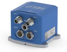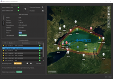
SBG Systems Releases Virtual Base Station Feature in Qinertia
SBG Systems is introducing the Virtual Base Station feature in its in-house post-processing software called Qinertia. Geospatial professionals benefit from an optimal centimetric position accuracy in all their projects, even...