Intel Acquires UAV Manufacturer MAVinci
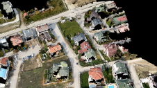
Intel has acquired MAVinci, a start-up from one of ESA’s business incubators in Germany that has developed an easy-to-use system for land surveillance. Anil Nanduri, head of Intel’s drone business,...

Intel has acquired MAVinci, a start-up from one of ESA’s business incubators in Germany that has developed an easy-to-use system for land surveillance. Anil Nanduri, head of Intel’s drone business,...
With the boom in the use of consumer-grade cameras on unmanned aerial vehicles (UAVs) for surveying and photogrammetric applications, this article seeks to review a range of different cameras and...
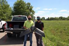
Ohio-based energy provider Dayton Power & Light is employing a fleet of senseFly eBee X fixed-wing drones to improve its large-scale data collection and mapping capacity in partnership with Sinclair...

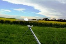
DŠGS asked themselves how to build a UAV and they built one: the FlyEye, it exceeded all goals and expectations. The DŠGS FlyEye is an unmanned aerial vehicle (UAV) built...
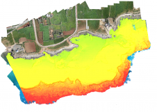
Accurate bathymetric mapping of shallow areas is essential for many offshore activities. Through Structure from Motion (SfM) and Multiview Stereo (MVS) techniques, images can provide a low-cost alternative compared to Lidar...

Leica Geosystems, Aibotix and Headwall Photonics have introduced an integrated high performance airborne sensor solution utilising a hyperspectral imager and the Aibot X6 UAV. The Nano-Hyperspec sensor was optimised in...
Maptek has made a significant investment in DroneMetrex, a start-up company from Adelaide, Australia, that has developed technology for aerial photogrammetric mapping from UAVs. The DroneMetrex system enables users to...

Harxon demonstrated its dedication to innovation at Intergeo 2023 by introducing two products designed to advance high-accuracy positioning within the geospatial industry: the Survey GNSS Antenna (HX-CSX600A) and the Helix...

RIEGL Laser Measurement Systems and Applanix Corporation have announced that the Applanix AP50 GNSS-Inertial sensor system was successfully integrated with RIEGL’s VQ-820-GU topo-bathymetric airborne laser scanner on board the Schiebel...
When it comes to monitoring the condition of roads, UAV technology can overcome many of the downsides associated with traditional methods, which can be time-consuming, labour-intensive and sometimes subjective. This...
This site uses cookies. By continuing to use this website, you agree to our Cookies Policy. Agree