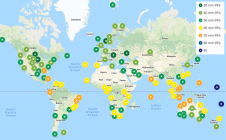
Why hasn’t the Earth observation industry taken off?
The Earth observation industry seems to be on a slow burn – but why? Brace yourself for a ‘rollercoaster ride’ through Earth observation as this article unravels the mysteries behind...

The Earth observation industry seems to be on a slow burn – but why? Brace yourself for a ‘rollercoaster ride’ through Earth observation as this article unravels the mysteries behind...

A global audience of geospatial professionals witnessed the presentation of the JOUAV VTOL Hangar, a groundbreaking development in the field of vertical take-off and landing (VTOL) drones, at Intergeo 2023....
On 24 January 2023, the European Union declared the Galileo High Accuracy Service (HAS) operational for testing, and it is scheduled to become fully operational in 2024. This free signal adds...

Hexagon has joined forces with NVIDIA in a collaborative effort to advance industrial digital twin solutions that combine reality capture, manufacturing twins, AI, simulation and visualization. The goal is to...

‘Smart agriculture’, i.e. the efficient use of Earth's resources to feed the world, requires accurate and advanced data acquisition, modelling and management. UAVs can play a critical role in this....

Advanced Navigation has acquired Vai Photonics, a spin-out from the Australian National University (ANU) developing patented photonic sensors for precision navigation. Advanced Navigation is one of the world’s most ambitious...
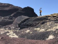
NASA researchers and their industry partners have developed a remote sensing mapping system to aid explorers in the most isolated wilderness imaginable: the airless wastes at the South Pole of...
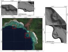
The accuracy of coastline data in Indonesia could be much improved by making use of Lidar bathymetry technology. In this article, the authors describe how Lidar bathymetry survey techniques were...
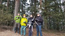
The Finnish Geospatial Research Institute (FGI) has recently added the RIEGL VQ-840-G airborne laser scanner to its impressive collection of sensors. FGI innovators are true scientists, moving the 3D industry...
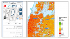
These five practical examples from Israel illustrate the role of governments, spatial data and technologies in developing a smart nation. The Fourth Industrial Revolution brings about new advancement and abilities...
This site uses cookies. By continuing to use this website, you agree to our Cookies Policy. Agree