ESRI Holdings acquires GeoWise Ltd
ESRI Holdings, a group of companies including ESRI (UK), ESRI Ireland and Helyx SIS, has acquired GeoWise Ltd, a provider of visualisation software for location-based statistical data, complementing the group's...
ESRI Holdings, a group of companies including ESRI (UK), ESRI Ireland and Helyx SIS, has acquired GeoWise Ltd, a provider of visualisation software for location-based statistical data, complementing the group's...
With the recently launched Point2Point personal navigation device, Middle Eastern consumer electronics leader Hügel GmbH and Tele Atlas, a leading global provider of digital maps and dynamic content for navigation...

GAF AG (Germany) has signed a contract with the Ministry of Energy, Mines, Water and Environment in the Kingdom of Morocco and the beginning of work for the geological mapping...

GfK GeoMarketing will be releasing an English version of its geomarketing solution RegioGraph 2009 in August 2009. The software has a wide range of applications for sales, marketing, expansion and...
GfK GeoMarketing will be releasing an English version of its geomarketing solution RegioGraph 2009 in August 2009. The software has a wide range of applications for sales, marketing, expansion and...
A framework contract covering the acquisition and provision of TerraSAR-X radar satellite data worth EUR2.2 million, as well as the implementation of a direct ordering tool for this data, worth...
Tele Atlas and CADTECH announced the availability of the first fully navigable digital databases of Morocco for personal navigation, wireless, Internet, automotive and enterprise navigation solutions companies worldwide. The maps,...
The latest release of ESRI's ArcGIS Data Appliance includes significantly enhanced maps in a new tiling scheme and simplified licensing. All the datasets on the preconfigured network storage device have...
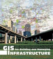
GIS for Building and Managing Infrastructure, the latest book from ESRI Press, presents maps from nine countries and 57 organisations, illustrating the versatility of geographic information system (GIS) technology when...
Users of mapping applications and GPS devices will soon be able to travel more efficiently on congested roadways, minimise transportation costs and find the most optimal routes to their destinations....
This site uses cookies. By continuing to use this website, you agree to our Cookies Policy. Agree