Transferring Theory into Practice
In 1980 Professor Ackermann founded INPHO GmbH as a spin-off from his institute at Stuttgart University. A quarter of a century later, the company looks like staying independent for another...
In 1980 Professor Ackermann founded INPHO GmbH as a spin-off from his institute at Stuttgart University. A quarter of a century later, the company looks like staying independent for another...
To monitor the environmental changes and find solutions in the vulnerable Sahel region, the AGRHYMET institute (AGRiculture, HYdrology and METorology) was established thirty years ago. AGRHYMET aims at collecting, processing...
One of the main recommendations put forward at the Third United Nations Conference on the Exploration and Peaceful Uses of Outer Space – UNISPACE III – was the need to...
The tsunami in Asia has once again demonstrated that human beings are at risk at any time, anywhere. Disasters in highly populated environments are difficult to manage using only small-scale...
Cadastral information is a fundamental layer in the Spatial Data Infrastructure (SDI) and many GIS systems use it as a base framework. The authors introduce an approach to improve and...
Approximately 21,000,000 properties exist in England and Wales, ranging from small houses with tiny gardens to large rural estates. Boundary disputes are relatively rare and involve an average of 100mm...
Optech Incorporated focuses on the development, manufacture and support of advanced, lidar-based survey solutions. Established in 1974 as a privately held, Canadian-owned research and development firm, Optech was originally an...
The Government of India on 19th May 2005 approved a radical New National Map Policy, ending decades of restrictive practise that had hampered geospatial development on the subcontinent (see Pinpoint...
The Government of India on 19th May 2005 approved a radical New National Map Policy, ending decades of restrictive practise that had hampered geospatial development on the subcontinent (see Pinpoint...
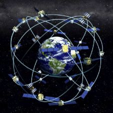
Receiver position is calculated from the position of satellites and the distances to them. Distance is calculated from the time a radio signal travels between satellite and receiver. But how...
This site uses cookies. By continuing to use this website, you agree to our Cookies Policy. Agree