Integrating UAS and Multibeam Echosounder Data
Knowing the volume of material present in a gravel quarry can make the difference between profit and loss. A gravel quarry in Hartheim am Rhein, southwest Germany, is partially covered...
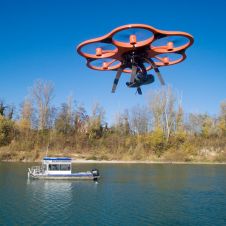
Knowing the volume of material present in a gravel quarry can make the difference between profit and loss. A gravel quarry in Hartheim am Rhein, southwest Germany, is partially covered...

Irregular settlements, also known as 'villas' or 'favelas', present a big challenge in urban planning. When collecting data, whether to determine the existing situation or to plan future projects, topography...
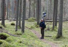
Evolution of Laser scanning: new prototype which can be held in a backpack for rugged terrain. Laser scanning systems have gone through a major evolution in the past decade. After the initial breakthrough of airborne laser scanners (ALS), other types of laser scanning systems have emerged,...

Data is essential for any GIS. Fortunately today there is a vast array of rapid data capture technologies. GIS Professional’s sister publication Geomatics World reports from the world’s biggest exhibition...
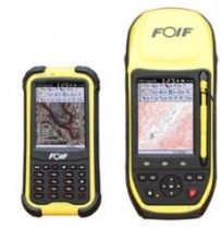
Supergeo Technologies, a GIS software and solution provider, has announced a cooperation agreement with Suzhou FOIF Co. (FOIF) to provide worldwide surveyors with a high-accuracy GIS turnkey solution. Mobile GIS...
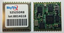
SkyTraq, a Taiwan-based GNSS positioning technology company, has introduced the all-in-one S2525DR8 GNSS dead-reckoning module with onboard integration of MEMS sensor and interface logic. The module is especially suitable for...
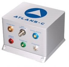
Following iXBlue’s ATLANS-C product release in February 2014, Pathway Services, the largest road and pavement-condition service provider in the USA, decided to put ATLANS-C to field test, focusing on its...
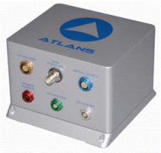
iXBlue, a leading provider of navigation, positioning and mapping solutions, has launched its new ATLANS-C position and orientation system, developed in close cooperation with Septentrio Satellite Navigation. The system is...

FOIF (Suzhou FOIF Co., Ltd.) is located in Suzhou Industrial Park in China, near Shanghai. The company has integrated the disciplines of R&D, manufacturing, sales, logistics and after-sales service to...
Modern surveying often relies on data from satellite-based GNSS systems, as do modern navigation systems, too. But what if there is no satellite reception? This could be the case underground,...
This site uses cookies. By continuing to use this website, you agree to our Cookies Policy. Agree