Leica Geosystems Introduces New 3D Laser Scanning Bundle
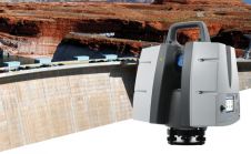
Leica Geosystems, a Hexagon company, has announced a new 3D laser scanning bundle for the Leica BLK360 and greater integration with Autodesk ecosystem. The new bundle consists of the Leica...
Leica Geosystems, a Hexagon company, has announced a new 3D laser scanning bundle for the Leica BLK360 and greater integration with Autodesk ecosystem. The new bundle consists of the Leica...
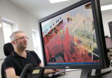
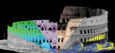
Engineering consultancy Hatch has transformed its handling of laser-scanned data on major infrastructure projects by using Pointfuse software to classify and manipulate billions of individual measurements. Originally used on a...

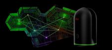
Lidaretto is flexible and compact Lidar scanning system developed since 2015 and uniquely designed to be used the way that fits best to users’ specific application. You can easily mount...
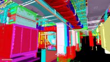
Pointfuse has released the latest version of its advanced point cloud processing software that converts the millions of individual measurements captured by laser scanning and photogrammetry. Featuring new streamlined classification...

The RIEGL VZ-400i Terrestrial Laser Scanner was used for data acquisition of 2.5 kilometers of the cave labyrinth (the part of the cave open for tourists) in 2017 and a...
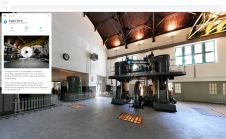
NavVis, a provider of indoor spatial intelligence solutions for enterprises, has announced the launch of NavVis Cloud, a new cloud-based platform that gives laser scanning professionals access to NavVis IndoorViewer...
Leica Geosystems has announced the Leica ScanStation P50, the fastest and safest long-range 3D laser scanner, as the newest member of the 3D terrestrial laser scanner P-Series. The P50 combines...

A combination of high dynamic range imagery and 3D laser scanning generates a virtual version of the environment, producing 100%-realistic computer graphics (CG) renderings. The Mill, a renowned VFX and creative...
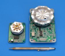
Precision Laser Scanning, based in Scottsdale, Arizona, USA, has announced its Gecko series of ultra-compact polygon scanners. Geckos have the motor polygon assembly mounted directly to the control board and...
RIEGL is pleased to announce the release of a major update to their Terrestrial Laser Scanning Software Suite of RiSCAN PRO, RiMINING and RiSOLVE! The update includes a number of...
This site uses cookies. By continuing to use this website, you agree to our Cookies Policy. Agree