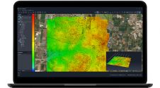
To be useful, the millions or even billions of 3D points generated by a variety of active and passive sensors need to be stored, organised, combined, georeferenced, measured and analysed, and these tasks all require software. That the storage of billions of 3D points is an issue in itself is shown in the article by Martin Kodde in the July 2014 issue of GIM International. (By Mathias Lemmens, senior editor, GIM International) The LAS storage format, initially developed for airborne Lidar, has become a de facto standard. The more generic E57 format based on XML supports meta data, 2D imagery...
(read more)