Virtual Exploration of Mars
On 2 February 2009, NASA and Google released a new Mars mode in the new Google Earth 5.0 that brings to everyone's desktop a high-resolution, three-dimensional view of the Red...

On 2 February 2009, NASA and Google released a new Mars mode in the new Google Earth 5.0 that brings to everyone's desktop a high-resolution, three-dimensional view of the Red...
Virtual Geomatics (TX, USA) and Sanborn have agreed to procure Virtual Geomatics VG4D software solutions for Sanborn\'s LiDAR operations. The Virtual Geomatics\' software solutions will initially be deployed for production...
Vexcel Corp. (CO, USA) has made available the Virtual Earth Appliance, designed to bring the data and functionality of the Microsoft Virtual Earth Internet service to the offline customer. The...
Leica Geosystems Geospatial Imaging (GA, USA) has released Leica Virtual Explorer 3.1. This version offers several enhancements, such as new tools for third-party integration and additional texture and navigation options....
Since its launch in June 2005 Google Earth has attracted not only the millions of people across the world who fly virtually across continents and jump over mountains, but has...
Microsoft Corp. (WA, USA) has announced beta availability of MSN Virtual Earth. The service enables users to search, discover, explore, plan and share information and activities relevant to specific U.S....

At Bentley System’s annual conference for infrastructure thought leaders, CEO Greg Bentley presented a keynote speech. He stated that since Bentley Systems’ acquisition and assimilation of ContextCapture software in 2015, the...
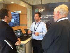
Yesterday (16 July) was the last day of the exhibition on the second floor. Many businesses showed their products and services, allowing the congress visitors to touch the products and...
This site uses cookies. By continuing to use this website, you agree to our Cookies Policy. Agree