• Newsletter
  • Contact
  • Advertise
  • About us
GIM International
  • News
    • Latest News
    • Archive
    • Newsletter
    • Lidar
    • GNSS
    • UAV/UAS
    • GIS
    • GPS
  • Articles
    • Latest Articles
    • Features
    • Case Studies
    • Interviews
    • Columns
    • Blogs
    • Archive
  • Case Studies
  • Magazines
    • GIM International
    • Geomatics World
  • Companies
  • Events
  • Videos
  • Topics
    • Remote sensing
    • Cartography & GIS
    • Marine surveying
    • Land surveying
GIM International
FLIR's US$200 Million Takeover of Aeryon Labs

FLIR's US$200 Million Takeover of Aeryon Labs

Jan 29, 2019, 1:22:00 PM

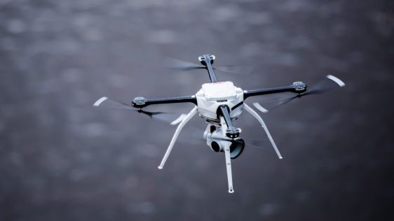
FLIR Systems, the US-based global manufacturer of thermal imaging infrared cameras, has confirmed its takeover of the Canadian firm Aeryon Labs, a developer of high-performance unm...

Read more→
UAV

New Autonomy and Mapping Solutions at Commercial UAV Expo

September 1, 2021

The Commercial UAV Expo is the place to learn about the most exciting new technologies in UAVs. Returning this year, it hosts an innovative solution with the official unveiling of Emesent’s latest ...

Read more→
UAV

Innovative Partnership Augments Single Rotor UAV Taking Off

March 4, 2021

SPH Engineering announced that the Velos UAV helicopter has passed field tests to become the first single rotor helicopter supported by UgCS software. UgCS now enables helicopter professionals to use...

Read more→
UAV

Atmos UAV and Topcon Join Forces for RTK Reference Network Solutions

December 3, 2020

Atmos UAV has formed a new partnership with Topcon towards a base station-free era. Atmos UAV is a fast-growing Dutch drone manufacturer that develops high-end VTOL fixed-wing drones for surveying and...

Read more→
UAV

LiDARUSA Offers New Aircraft to Carry Full Range of UAV Scanners

October 28, 2019

LiDARUSA, a leading company in the design and integration of Lidar sensors, has announced a partnership with Innoflight Technology, a manufacturer specializing in unmanned aerial vehicle (UAV or 'dron...

Read more→
UAV

Terra Drone Launches UAV and AI-based Solution for Power Asset Inspection

October 8, 2019

Terra Drone Corporation, a leading provider of industrial unmanned aerial vehicle (UAV or' drone') solutions, has unveiled a new UAV and artificial intelligence-based solution set for the maintenance ...

Read more→
UAV

Atmos UAV Integrates Thermal, Multispectral and High-resolution Imagery

August 15, 2019

Atmos UAV, a drone manufacturer for mapping and surveying from Delft, the Netherlands, continues to expand its payload options. The most recent addition is the new MicaSense sensor, Altum, which integ...

Read more→
UAV

Atmos UAV Sets Foot in Southeast Asian Market

August 1, 2019

Atmos UAV, a Dutch manufacturer that develops high-end VTOL fixed-wing unmanned aerial vehicles (UAVs or 'drones') for surveying and mapping, has appointed Sonar Nusantara as its official distributor ...

Read more→
UAS

Taking Full Advantage of the Benefits of UAS Technology

June 25, 2019

Leveraging UAS technology across surveying and engineering sectors is demanding. Meeting the expectations of accuracy and accountability requires the best in expertise, methodology and equipment. The ...

Read more→
UAV

Plowman Craven Awarded Network Rail UAV Contract

June 11, 2019

Plowman Craven has been awarded a national framework agreement with the UK's Network Rail for the provision of unmanned aerial vehicle (UAV or 'drone') services. The survey measurement and consultancy...

Read more→
UAV

Aizawa Concrete Partners with Top Flight Technologies for Aerial Inspection

June 4, 2019

Aizawa Concrete Corporation has announced a strategic partnership with Top Flight Technologies, a leading provider of heavy-lift, long-range (HLLR) hybrid-electric unmanned aerial vehicle (UAV) techno...

Read more→
  • ←Prev
  • 1
  • 2
  • 3
  • 4
  • 5
  • Next→
GIM International
Geomares
GIM International is the independent and high-quality information source for everything the global geomatics industry has to offer, online and offline! We provide information about all the major topics in the business, such as mapping & surveying, geodesy, cartography, Lidar, GIS, photogrammetry, UAV/UAS, GNSS, remote sensing and more.

Themes

  • Lidar
  • GIS
  • UAS/UAV
  • GPS
  • GNSS
  • Mobile Mapping
  • Point Clouds

General

  • Advertise
  • About us
  • Contact
  • Contribute

Follow GIM

  • Newsletter
  • Facebook
  • LinkedIn
  • Twitter
  • News RSS Feed
  • Articles RSS Feed
  • Privacy
  • Cookies
  • Terms & Conditions
  • Sitemap
  • Contact
  • Advertise

© 2023 Geomares. Copyright reserved.

GIM International
  • News
    • Latest News
    • Archive
    • Newsletter
    • Lidar
    • GNSS
    • UAV/UAS
    • GIS
    • GPS
  • Articles
    • Latest Articles
    • Features
    • Case Studies
    • Interviews
    • Columns
    • Blogs
    • Archive
  • Case Studies
  • Magazines
    • GIM International
    • Geomatics World
  • Companies
  • Events
  • Videos
  • Topics
    • Remote sensing
    • Cartography & GIS
    • Marine surveying
    • Land surveying

This site uses cookies. By continuing to use this website, you agree to our Cookies Policy. Agree