Android Vehicle Tracking App
Masternaut has released a feature-rich vehicle tracking application for Android smartphones. The web-based service allows users to keep track of company vehicles and fleets on smartphones and tablet PCs from...

Masternaut has released a feature-rich vehicle tracking application for Android smartphones. The web-based service allows users to keep track of company vehicles and fleets on smartphones and tablet PCs from...

UK-headquartered aerial survey company Bluesky has launched a fast response aerial survey service using unmanned aerial vehicles (UAV) or drones. The technology, originally developed by the military, includes Artificial Intelligence...
Emesent, an Australian autonomous mapping and data analytics startup, is ready to execute its ambitious global expansion plans after closing an oversubscribed US$23 million Series A round. The raise was...
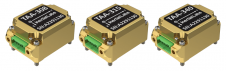
Inertial Labs has unveiled its latest innovation: high-precision three-axis accelerometers (TAA). These compact, self-contained devices mark a significant leap forward in navigation-grade accelerometers, promising unmatched precision in measuring linear accelerations....

Blue Marble Geographic’s flagship software, Global Mapper Pro, is an all-in-one GIS package for analysing and processing vector, terrain, image and point cloud data. Compatible with over 380 different file...
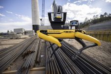
Trimble and Exyn Technologies, a pioneer in multi-platform robotic autonomy for complex, GPS-denied environments, have entered a strategic collaboration to explore the use of autonomous construction surveying technology. The solution...
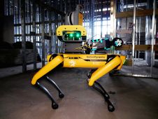
Trimble has released the X7 3D laser scanner and FieldLink software fully integrated with Boston Dynamics' Spot robot. This turnkey solution from Trimble, jointly developed with Boston Dynamics, facilitates autonomous...
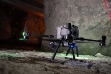
It can still be difficult to achieve centimetre-level accuracy in mobile mapping, especially in GNSS-denied or challenging areas such as in deep urban canyons, under foliage or through tunnels. However,...

In a high-flying endeavour spanning over six decades, the UK’s National Grid's fleet of advanced helicopters have been diligently patrolling pylons and power lines, ensuring the health and reliability of...
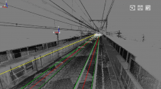
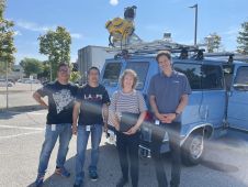
Nippon Insiek and SITECO Informatica have announced the provision of an advanced road-scanner system to Japan’s leading railway company, JR East, to support JR East’s response to the quest for...
This site uses cookies. By continuing to use this website, you agree to our Cookies Policy. Agree