Premium Precision Engineering in Northern Germany
The annual Oldenburger 3D-Tage event, which content manager Wim van Wegen described as a 'Geheimtipp' a couple of years ago, is held in the northern German city of Oldenburg and...
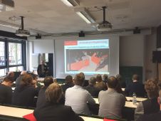
The annual Oldenburger 3D-Tage event, which content manager Wim van Wegen described as a 'Geheimtipp' a couple of years ago, is held in the northern German city of Oldenburg and...

The world of professional unmanned aerial vehicles (UAVs or ‘drones’) is changing. It is a matter of ‘survival of the fittest’ in terms of the hardware aspect: UAV manufacturers. The...
DJI and Leica Geosystems have announced a strategic partnership, together with Aibotix, that will bring together prominent technology portfolios to drive adoption of unmanned aerial vehicles (UAVs) in the surveying and construction...

Is the 3D model becoming the only deliverable? For construction, is photogrammetry a better option than LiDAR? How long before modelling software can calculate costs? When should you start mentioning...
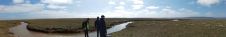
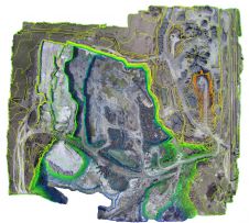
Coastal and estuarine saltmarsh has long been recognised as having key physical, ecological, and recreational value, acting as sediment and nutrient traps and as natural coastal protection structures functioning as...

DroneDeploy has announced the beta release of its new Fieldscanner product offering real-time drone mapping, just in time for the spring growing season. With Fieldscanner, available as part of DroneDeploy's...

While many companies bet on lidar systems to lead the autonomous car industry, the privately held company Echodyne is developing a different way of sensing the world with “radar vision”. In 2014,...
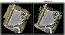
Anyone involved with structure-from-motion (SfM) photogrammetry has probably questioned which type of processing software is necessary for them to produce quality 3D point cloud data. Many SfM software packages exist...
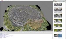
Unmanned aerial survey (UAS) photogrammetry has proven to be a good alternative for capturing open-pit mines, but it is expensive when done professionally. This article investigates whether low-cost UAS photogrammetry,...
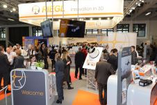
Austria-based RIEGL once again introduced a new range of Lidar products at this year’s Intergeo, varying from laser scanners to various software solutions. At the geospatial industry’s leading international trade...
This site uses cookies. By continuing to use this website, you agree to our Cookies Policy. Agree