Kitty Hawk Acquires 3D Robotics
Kitty Hawk is buying what’s left of one-time DJI competitor 3D Robotics. Aircraft manufacturer Kitty Hawk produces electric personal air vehicles and is financially supported by Google co-founder Larry Page....
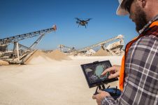
Kitty Hawk is buying what’s left of one-time DJI competitor 3D Robotics. Aircraft manufacturer Kitty Hawk produces electric personal air vehicles and is financially supported by Google co-founder Larry Page....

The Zenmuse L1 is the first Lidar payload developed by DJI, integrating a Livox Lidar module, a high-accuracy IMU and a camera with a 1-inch CMOS on a 3-axis stabilized...
Rokubun has developed a fast and flexible cloud-based PPK engine, known as JASON, aimed at democratizing precise positioning in the GNSS market. Post-processed kinematic (PPK) GNSS has been a hot...
DJI recently introduced the P4 multispectral, a high-precision unmanned aerial vehicle (UAV or ‘drone’) which exploits the integration of multispectral cameras to facilitate agricultural and environmental monitoring applications. Therefore, imagery...
This article presents a participative geomatics project with the goal of increasing southern Québec’s coastal communities’ ability to map and monitor changes in their coastal environment. Capacity-building and empowerment using...

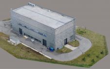
Phase One has announced the P3 Payload, a versatile solution designed for fast, efficient, and safe inspection of critical infrastructure with a UAV (unmanned aerial vehicle or 'drone'). The P3...
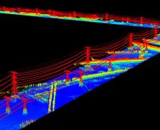
With the rapid development of civil construction and the increasing demand for electricity in recent years, the market segment of power grid construction has grown significantly. Meanwhile, how to efficiently...
Small improvements to a drone Lidar survey can make big differences in efficiency, productivity and safety. The drone's battery life impacts on the drone's flight time and is a major...
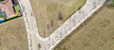
The technique known as structure from motion (SfM) has been suggested as a valid alternative to traditional photogrammetric methods. In a project in Glasgow, UK, an RTK-based point-to-point validation technique...
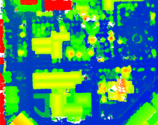
Modelling of urban areas, with emphasis on flat roof drainage calculations, is one application field in which the use of UAVs has significantly increased in recent years. A calibration base,...
This site uses cookies. By continuing to use this website, you agree to our Cookies Policy. Agree