Found 421 results
Sort by

DJI Launches Phantom 4 RTK Globally

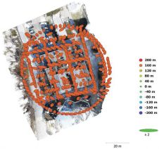
DJI, a world leader in civilian drones and aerial imaging technology, has announced the global rollout of the Phantom 4 RTK, a high-precision aerial survey drone that combines centimetre-level navigation...

Read more

OS Net - Preparations for Future GNSS

Ordnance Survey (OS) has just updated its geodetic infrastructure. Mark Greaves, Lead Consultant at Geodesy, describes these developments and takes a look at shorter and longer-term geodetic issues for surveyors....

Read more

GNSS, Cadastres and Drones

Richard Groom summarises some of the interesting papers from the FIG Congress focussing on GNSS, Hydrography, 3D Cadastre and mapping. GNSS – Detecting Cycle Slips Roberts and Hancock (TS03E) presented...

Read more