Teledyne DALSA Introduces Remote RadEye X-ray Camera
Teledyne DALSA, a Teledyne Technologies company and a global leader in digital image sensing technology, has introduced the new Remote RadEye HR X-ray camera. It is positioned as a flexible...
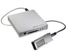
Teledyne DALSA, a Teledyne Technologies company and a global leader in digital image sensing technology, has introduced the new Remote RadEye HR X-ray camera. It is positioned as a flexible...
The AGISEE SDI workshop is organised by the Association for Geospatial Information in South-East Europe as part of the 4th Croatian NSDI and INSPIRE Day and 8th Cartography and Geoinformation...

The European Environment Agency (EEA) has contracted GAF AG, Germany, to map high-resolution Forest and Impervious Area characteristics for two lots in West, Central and South-Eastern Europe in the framework...
In 2014, DMCii is to launch a constellation of 1m-resolution sensors, built by Surrey Satellite Technology Ltd (SSTL, UK). Specialists from the UK-based DMCii company spoke about the activities for...
The American Society for Photogrammetry and Remote Sensing (ASPRS) is working actively to support establishment of the National Land Imaging Program (NLIP), a long-range operational moderate resolution imaging program. For...
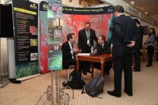
Influential business leaders across the UK are calling for more graduates with advanced technology and business skills to help them use high-tech systems more effectively across their organisations. According to...
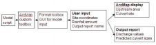
Estimating rainfall discharge is difficult in large catchment areas with varying topography. This leads to widespread inadequacy in culvert design, with resultant damage to these and other drainage infrastructure during...
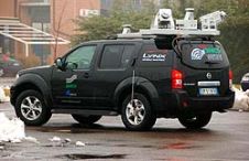
The use of Mobile Lidar systems enters the scene when large areas have to be surveyed at accuracy and resolution exceeding those available through aerial photogrammetry, and when using static...
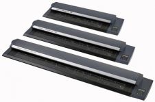
Colortrac began shipping the SmartLF Gx+ 56 extra-wide format scanners in March 2009; the first scanners in the all-new SmartLF Gx+ large-format scanner range. Now, two new Gx+ scanner models...
Initiated at Delft University of Technology in the Netherlands, CycloMedia has evolved into an international organisation. For many years the company has been a major player in large-scale, systematic visualisation...
This site uses cookies. By continuing to use this website, you agree to our Cookies Policy. Agree