Contribution of Hydrography towards Sustainable Water Management
The 2019-2020 year has been a busy one with the Working Groups of Commission 4 focussing on representing FIG at a number of events and forum to gain insight to...

The 2019-2020 year has been a busy one with the Working Groups of Commission 4 focussing on representing FIG at a number of events and forum to gain insight to...
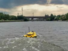
This paper explores the various features of the Apache USV series for efficient seafloor-level mapping. The CHCNAV hydrographic survey software is used for data recording and analysis. It provides results...
Various multibeam Lidar sensors are suited for mobile mapping. Read this article to learn more about their features and productivity. In mobile mapping, geospatial data is acquired by one or...
How can AUVs be reliably used to map the 3D structure of the underside of sea ice, especially now that the climate crisis makes it more important than ever to...

While there is still lots of ocean mapping work to do on Earth, oceans situated elsewhere in our solar system hold plenty of mysteries too, writes Wim van Wegen in...

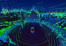
Following its emergence more than a decade ago, digital twin technology has developed to become a complex and comprehensive technical system that supports the construction of new smart cities. It...
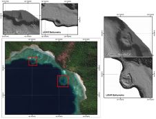
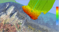
The accuracy of coastline data in Indonesia could be much improved by making use of Lidar bathymetry technology. In this article, the authors describe how Lidar bathymetry survey techniques were...
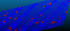
XOCEAN has completed 35 cable inspection surveys using a combination of uncrewed surface vessels (USVs) and uncrewed aerial vehicles (UAVs) between the Scottish mainland and Western Isles. There was a...
Time issues associated with processing point clouds are hugely frustrating, but they are nothing new. And the shifting boundaries mean that we’re destined to forever play the waiting game, according...
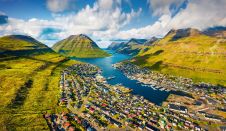
Crewless aerial mapping was recently chosen when surveying the Faroe Islands. For the small team, labour savings provided one advantage of a UAV-based approach. Another benefit was that clear skies...
This site uses cookies. By continuing to use this website, you agree to our Cookies Policy. Agree