Sony Camera Payload for DJI Drones from Klau Geomatics
With the end of the DJI X4s camera, drone operators have been looking for a quality mapping camera solution for the Inspire 2 and M200/M210/M210V2 drones. Klau Geomatics has released...
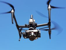
With the end of the DJI X4s camera, drone operators have been looking for a quality mapping camera solution for the Inspire 2 and M200/M210/M210V2 drones. Klau Geomatics has released...
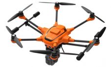
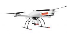
UAV manufacturer Yuneec has released a new version of its commercial hexacopter platform with an integrated RTK unit from Swiss firm Fixposition. The H520 RTK is capable of 1cm +...
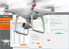
Klau Geomatics, specialised in PPK hardware and post-processing software, recently announced its new PPK software for the DJI Phantom4 RTK drone. The software enables professional users to achieve the most...

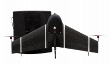
senseFly recently announced its brand-new UAV solution called eBee X, giving 'GIM International' a good excuse to pose a few questions to the company’s CEO, Gilles Labossière, who joined senseFly...
UAS (Unmanned Airborne Systems) are rapidly becoming a valuable source of data for inspection, surveillance, mapping and 3D modelling projects. Investment in the commercial UAS industry - estimated to increase...
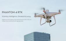
DJI, a world leader in civilian drones and aerial imaging technology, has announced the global rollout of the Phantom 4 RTK, a high-precision aerial survey drone that combines centimetre-level navigation...
Microdrones has announced the launch of mdLiDAR3000, its newest Lidar system that combines the heavy lifting power of the md4-3000 drone with a RIEGL Lidar and a Sony camera for rapidly...
Geospatial information gathered by unmanned aerial vehicles/systems (UAVs/UASs or ‘drones’) is now the driver for business success across many industries and applications. To develop the right tool for this data...
Over the past few years, photogrammetry, remote sensing and spatial information science have witnessed great achievements, mainly due to societal, political, environmental and technological changes worldwide. Human mobility has significantly...
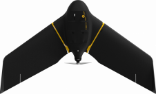
senseFly, a leading provider of fixed-wing drone solutions, has introduced its newest mapping tool, the eBee X. Launched with the promise that “it’s not about the drone” but instead about...
This site uses cookies. By continuing to use this website, you agree to our Cookies Policy. Agree