Photogrammetry – Recent Developments and the Way Forward
Over the past few years, photogrammetry, remote sensing and spatial information science have witnessed great achievements, mainly due to societal, political, environmental and technological changes worldwide. Human mobility has significantly increased due to population growth, climate change and globalization. Photogrammetric innovations have also been strongly influenced by the developments in information and communication technology (ICT), computer vision and robotics. Moreover, with the usage of active remote sensing techniques such as Lidar and radar for obtaining point cloud data – even from reflective surfaces such as metal or glass and uniform textures like snow, white surfaces or ice – the opportunities for data collection, analysis and integration have increased tremendously. So what can we expect next?
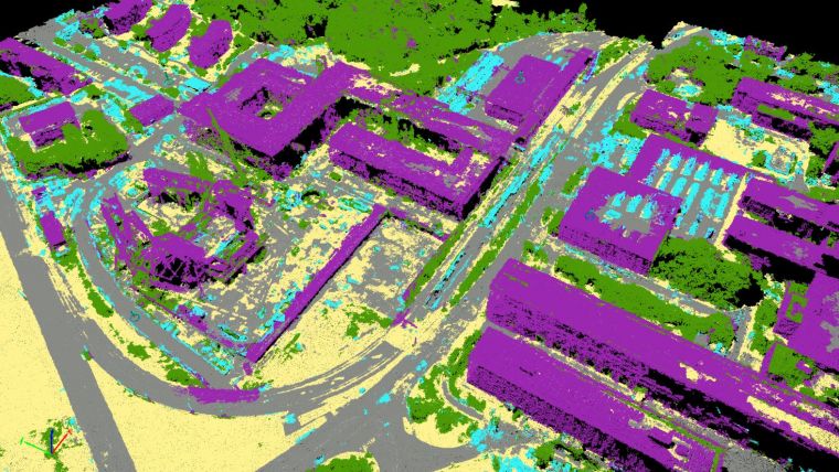
All this geospatial data is acquired, processed, stored and disseminated in ever-more advanced ways using geospatial infrastructures, cloud computing and crowd sourcing. New sensors are continuously appearing nowadays, such as SAR (InSAR/IfSAR), flash lasers, mobile Lidar and various cameras such as 3D and multispectral to name but a few. Having the opportunity to acquire data with high spatial, spectral, radiometric and temporal resolution has directly resulted in developments in photogrammetric image processing for deriving high-quality 3D information. In particular, dense matching boosted photogrammetry leading to high-density 3D data.
New applications using photogrammetric technologies
Recent years have also seen significant progress in automatic image orientation, surface reconstruction, scene analysis, change detection, classification and information extraction with the help of data mining, spatial statistics and machine learning. As a result, the number of new applications using photogrammetric technologies has increased significantly. Autonomous cars, which are equipped with cameras, laser scanners and radar sensors, are one recent example. To ensure safe driving, accurate real-time data processing is essential. Some other applications that are worth a mention are Earth system modelling, coastal monitoring, sustainable development, agriculture, cadastral and topographic mapping, cultural heritage, navigation, n-dimensional data modelling, object tracking, virtual and augmented reality and disaster management.
With the increasing variety of new and unconventional platforms, a new field in photogrammetry has emerged: UAV photogrammetry. Over the years, unmanned aerial vehicles (UAVs) have evolved from sole sensor-carrying platforms to automated flying robots with high-tech navigational and optical sensors on board. In the past, UAV flight missions that required a high level of geometric accuracy were necessarily accompanied by field measurements to include surveyed ground control points into the photogrammetric processing pipeline. Very often, this procedure took twice or three times as long as the time spent on the flight mission. This is especially true for large-scale mapping projects; the high costs of time-consuming ground truthing missions limited the exploitation of the full potential of UAVs. In recent years, however, the development of high-quality inertial measurement units (IMUs), global navigation satellite system (GNSS) technology and dedicated real-time kinematic (RTK) and post-processing kinematic (PPK) solutions promise accurate measurements which allow fast and easy image georeferencing. Tests carried out by related research projects (e.g. www.its4land.com) have shown that the utilization of such devices has the ability to increasingly minimise – or even eliminate – the need to measure ground control points.
All these developments have the potential to contribute to the successful achievement of the UN’s Sustainable Development Goals in which Earth observation (EO) provides indispensable data and insights. Photogrammetry in combination with other domains such as robotics, computer vision and mobile sensing for 3D simultaneous localisation can be considered as one of the disciplines which will contribute to the prosperity of our high-tech world.
Acknowledgements
The author would like to thank her PhD candidate Claudia Stöcker for her contribution to this column.
About the author
Mila Koeva is an Assistant Professor at University Twente, ITC, The Netherlands. Her main areas of expertise include 3D modelling, 3D cadastre, digital photogrammetry, image processing, producing large scale topographic and cadastral maps. She is project coordinator of its4land, a multidisciplinary European Commission Horizon 2020 project - www.its4land.com, co-chair of 3D GeoInfo 2018 and ISPRS WG IV/10.

Value staying current with geomatics?
Stay on the map with our expertly curated newsletters.
We provide educational insights, industry updates, and inspiring stories to help you learn, grow, and reach your full potential in your field. Don't miss out - subscribe today and ensure you're always informed, educated, and inspired.
Choose your newsletter(s)


