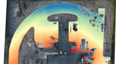
The Expanding Use of UAVs in Construction
It is an exciting time for geospatial professionals. The data that can now be obtained using unmanned aerial vehicles (UAVs, or drones) opens up previously impossible opportunities in many different...
It is an exciting time for geospatial professionals. The data that can now be obtained using unmanned aerial vehicles (UAVs, or drones) opens up previously impossible opportunities in many different...

The United States Geospatial Intelligence Foundation (USGIF) recently opened registration and housing for the GEOINT 2020 Symposium, taking place from 26-29 April, at the Tampa Convention Center in Tampa, Florida,...
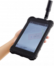
CHC Navigation has announced the availability of the LT700H RTK Android tablet designed to increase the efficiency and productivity of a mobile field workforce in any applications requiring centimetre to...
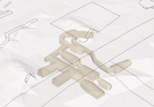
The urbanization trend is leading to an increasing number of people living in cities, thus also placing new demands on cadastral registration. To be able to register the complex infrastructures...
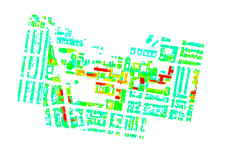
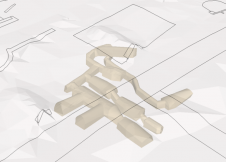
This innovative approach to measuring 3D urban growth integrates Lidar processing with machine learning. It takes account of the specific needs of urban planners, is less complicated to run and...
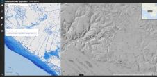
The major utilization of remote sensing data has been to compare images of an area taken at different times and identify the changes it underwent. With a wealth of long-term...
The urbanization trend is leading to an increasing number of people living in cities, thus also placing new demands on cadastral registration. To be able to register the complex infrastructures...
The remarkable capabilities of airborne Lidar continue to improve, with scanners now able to emit more than a million pulses every second. Although it has never been easier to acquire...
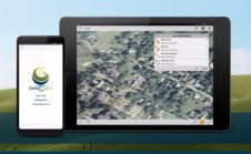
Blue Marble Geographics has announced that is mobile mapping application, Global Mapper Mobile, is now available to USA government agencies through the Innovative GEOINT Application Provider Program (IGAPP). Administered by...
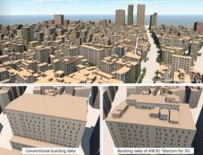
NTT DATA, an IT services provider, has announced the launch of AW3D Telecom for 5G, an advanced 3D digital map package that leverages high-quality satellite imagery for the planning of...
This site uses cookies. By continuing to use this website, you agree to our Cookies Policy. Agree