Found 344 results
Sort by

Inertial Navigation for Mobile Mapping

IXSEA announced a series of deliveries of LANDINS, the high-end INS positioning system specifically designed for mobile mapping and route mapping applications in dense urban areas, where GPS quality is...

Read more

Creative Minds and Clever Kit

Rapid developments in GIS technology and its applications, and thus growing demand for geospatial data, encouraged a group of friends including geodesists, IT people and foresters to create an innovative,...

Read more

Intergeo 2009: ALS, TLS and MLS

Intergeo 2009 took place in Karlsruhe from 22nd to 24th September with a conference and trade-fair. And despite the ongoing credit crunch, this fifteenth Intergeo exceeded all expect­ations of the...

Read more

Mobile Mapping System

Gispro have successfully implemented Land Based Mobile Mapping System (MMS/MLS). The system consists of Riegl laser scanners, digital videoscanners and ground-penetrating radar. Positioning and orienation are established using POS420 and...

Read more

Terrestrial Laser Scanning

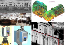
Terrestrial laser scanners are contact-free measuring devices which can collect dense point-clouds of objects. After processing each point is assigned with X, Y, Z coordinates; colour and reflectance value. The...

Read more

Laser Mapping Scanner for Kenya

Kenyan firm Ramani Geosystems has purchased a Riegl LMS Z420i laser scanner. The scanner can map the terrain in 3D up to 1,000 metres away with an accuracy of 10mm....

Read more