Laser Mapping Scanner for Kenya
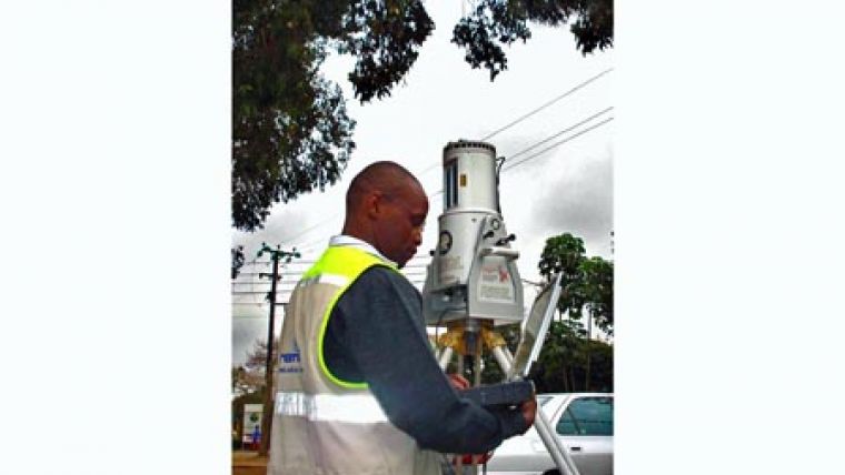
Kenyan firm Ramani Geosystems has purchased a Riegl LMS Z420i laser scanner. The scanner can map the terrain in 3D up to 1,000 metres away with an accuracy of 10mm. Thought to be the first high performance terrestrial laser scanner in the region, the scanner's rugged design is ideally suited for use in challenging environments.
Ramani Geosystems is a multi-disciplinary geospatial services company based in Nairobi. The company purchased the laser scanner in order to widen their portfolio of surveying solutions, deliver high end surveying services to existing clients and provide access to new markets.
The Riegl LMS Z420i is long range laser scanner, with a measurement range of 2 up to 1,000 metres and an accuracy of 10mm, with associated operating and processing software and a calibrated and accurately oriented and mounted high resolution digital camera.
Ramani Geosystems are a geospatial company operating in the region of Kenya, Tanzania, Uganda, Rwanda, Burundi, Sudan, Ethiopia and Somalia. They provide an extensive array of professional land surveying services, remote sensing data acquisition (aerial photography and satellite imagery) and GIS and mapping services. It is hoped the acquisition of the LMS Z420i will help the company meet the growing demand for detailed survey measurements from clients in the engineering, architectural, government, agricultural, mining and infrastructure sectors.

Value staying current with geomatics?
Stay on the map with our expertly curated newsletters.
We provide educational insights, industry updates, and inspiring stories to help you learn, grow, and reach your full potential in your field. Don't miss out - subscribe today and ensure you're always informed, educated, and inspired.
Choose your newsletter(s)


