Welcome to the Working (from home) Week
Today is 10 May and under normal circumstances, we the International Federation of Surveyors (FIG) would have our first General Assembly in the framework of the FIG Working Week 2020...

Today is 10 May and under normal circumstances, we the International Federation of Surveyors (FIG) would have our first General Assembly in the framework of the FIG Working Week 2020...

Images of Earth taken at night are revolutionizing our ability to measure and understand nearly every dimension related to human activity on Earth and allow us to get a glimpse...
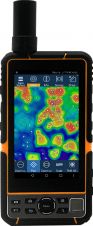
Elnav has launched its E-Tab series: industrial-level Android tablets with high-accuracy GNSS inside. The E-Tab series is designed for GIS professionals in the field and has advanced features for handheld,...
The focus of FIG Commission 2 is on innovative and effective professional education and training for surveyors. This involves curriculum development, innovations in teaching and learning, life-long learning, attracting new...

The 2019-2020 year has been a busy one with the Working Groups of Commission 4 focussing on representing FIG at a number of events and forum to gain insight to...
Commission 1 focuses on establishing a set of ethical principles that fits the surveying profession for reference by professional institutions. It also focuses on promoting greater understanding and improving community...
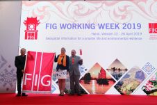
What is the ‘FIG Working Week’? It’s a strange name for a conference, but a name that has become close to a trademark and is significant for the many varied...

Unmanned aerial vehicles (UAVs or 'drones') are a powerful tool for stockpile measurement in industries such as mining, forestry and construction. They allow the same region to be flown regularly...
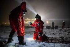
The Norwegian government recently announced comprehensive measures to combat the spread of the coronavirus, effective immediately. As a result, all travellers to Norway from non-Nordic countries who do not have...
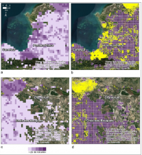
In a project in Haiti, several remotely sensed indicators were assessed to predict the completeness of Open Street Map for use in disaster relief and to guide future mapping efforts....
This site uses cookies. By continuing to use this website, you agree to our Cookies Policy. Agree