Found 53 results
Sort by

RADARSAT-2 To Be Launched in 2005

RADARSAT-2, Canada’s second Synthetic Aperture Radar (SAR) Earth observation satellite will offer users imaging flexibility and increased data information content, ensuring continuity of all existing RADARSAT-1 beam modes along with...

Read more

GI Technology for Developing Countries

Quality Standards Information Technology (QSIT) is an ICT consulting company which focuses upon developing specialised, custom, enterprise-level GIS, cadastral and telecom applications. The company has established a strong stand in...

Read more

Calibrating Survey Instruments

The geomatics profession is implicated in several ISO standards. The important ISO9001: 2000 prescribes regular instrument testing and calibration. To help meet required stringent alignment tolerances, a modern calibration bench...

Read more

Three Shows in a Row

The cusp carrying winter into spring saw three interesting geomatics shows across the USA from east to west. Tom Gibson, editor-in-chief of our US sister magazine, Professional Surveyor, visited one...

Read more

Road Extraction for Hazard Management

Many approaches have emerged for the (semi-)automatic extraction of roads and buildings from aerial and satellite imagery. What has been achieved so far, and what has still to be done?...

Read more

Smart RTS

Limitations in sampling rate and the detection of outliers impede use of the Robotic Total Station (RTS) for highly dynamic applications. The need to meet such requirements motivated the author...

Read more

Trimble Enhances Survey Solutions

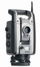
Trimble used Intergeo to introduce further enhancements to its complete surveying portfolio as part of its Connected Site solutions: new models of the Trimble S8 Total Station with options for...

Read more