Newly Independent Fugro Aerial Mapping
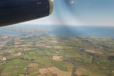
As of 1st January 2008, and after more than eight years as part of Fugro-Inpark BV, the Aerial Acquisition division (better known as FLI-MAP) is continuing life as a separate...
As of 1st January 2008, and after more than eight years as part of Fugro-Inpark BV, the Aerial Acquisition division (better known as FLI-MAP) is continuing life as a separate...
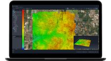
SimActive has unveiled the enhancement of Correlator3D for improved cloud environment productivity. With Correlator3D’s distributed processing capabilities, clients can seamlessly scale their processing in line with operational needs. The challenges...
Developing countries still have a need for mapping systems that are low-cost, simple to operate by local operators, fast in production and yet meet the needs of the application. A...
The Irish Department for Agriculture, Food and the Marine (DAFM) has awarded Getmapping a contract to supply new high-resolution aerial photography and digital height models for the Republic of Ireland....

Founded in 2017, ZZCOMM technology of geospatial hardware and software solutions provides rapid and high-accurate geospatial data for BIM, mining AEC, survey and mapping industries, whether they are indoor, outdoor,...
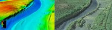
The US Geological Survey (USGS) and Dewberry have jointly released a new topobathymetric Lidar dataset for the Potomac River, extending from the Potomac Highlands in West Virginia to the Chesapeake...

When it comes to mapping the world’s roads, TomTom is a pioneer and one of the most experienced firms in the industry. It is now 20 years since its mobile...
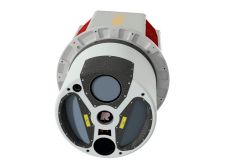
ClearSkies Geomatics, based in Colorado, USA, has recently added the RIEGL VQ-1560 II-S airborne laser scanner to its growing rental system fleet. This laser scanner, an advancement of RIEGL's dual-channel...

Calling all professionals! Please contribute to the 2024 edition of the annual geospatial industry survey by GIM International, which is currently in progress. This yearly tradition serves as a valuable...
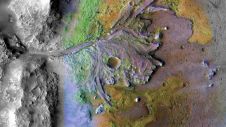
Using ground-penetrating radar, NASA’s Perseverance rover has uncovered compelling evidence of ancient lake sediment on Mars. This confirms the longstanding hypothesis that the Red Planet was once a warm, wet...
This site uses cookies. By continuing to use this website, you agree to our Cookies Policy. Agree