Techniques for Ash Cloud Mapping
An ash cloud from the Islandic volcano Eyjafjallajokull blocks the air traffic in parts of the UK and northern Europe. The UK Met Office has made available methods used for...

An ash cloud from the Islandic volcano Eyjafjallajokull blocks the air traffic in parts of the UK and northern Europe. The UK Met Office has made available methods used for...

Prague recently served as the testing ground for the integration of Mosaic’s 360-degree camera system with SmartDelta’s mobile mapping software. Known for its rich history and stunning architecture, the city...
The Point Cloud CAD 2010 is Microsurvey's latest product that allows the individual to work with Point Cloud and LIDAR data with ease. MicroSurvey has spent the last year working...
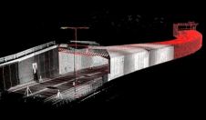
Point clouds are increasingly beginning to prove their worth in the construction industry, but the ability to work with point clouds within AutoCAD has been limited. Pointools Model makes it...
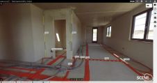
FARO recently announced a new update of SCENE WebShare Cloud, representing a substantial leap forward in worldwide secure 3D reality data exchange, collaborative project management and high-efficiency scan-to-BIM operations among...
Virtualgeo was established in 1994 as a spin-off from an established survey company active in the field of topographic survey and infrastructure planning since 1985. Virtualgeo has three offices in...
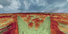
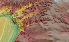
A dense annotated ground-truth Lidar dataset of the city of Dublin is the first of its kind regarding the accuracy, density and diversity of classes. The hierarchical labels offer excellent...
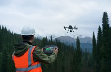
DJI selected Intergeo in Berlin as the stage for unveiling the DJI Zenmuse L2. This highly integrated Lidar system builds on the success of DJI’s Zenmuse L1 to bring new...
Virtual Surveyor has enhanced the Lidar elevation data handling capabilities in version 6.4 of its drone surveying and mapping software. The function enables users to select specific feature classes from...
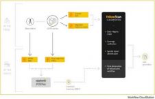
YellowScan, the UAV Lidar Solutions provider, has announced the release of CloudStation, its new software providing a complete solution to create and manipulate point cloud data. It allows the user...
This site uses cookies. By continuing to use this website, you agree to our Cookies Policy. Agree