The role of surveyors in building climate resilience
New knowledge and tools are needed if surveyors are to fulfil their critical role along the path to achieving humanity’s global climate goals related to land, water and the marine...
New knowledge and tools are needed if surveyors are to fulfil their critical role along the path to achieving humanity’s global climate goals related to land, water and the marine...
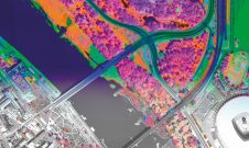
A pioneering project in Poland has proved that aerial mapping, combined with Lidar technology, can be an invaluable tool for accurately mapping the green urban environment. In fact, the new,...
What are the challenges of image-based data acquisition for photogrammetric mapping and mesh modelling? And how can photogrammetry be made accessible? The annual Open Day Photogrammetry provided some answers to...
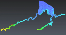
Flash floods pose a significant threat to communities in Fiji and the broader Pacific region. To address this pressing challenge and develop an interactive flood monitoring solution, an aerial Lidar...
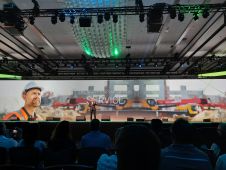
It is time to innovate with technology that can be applied ‘right here, right now’. That was the clear message during HxGN LIVE Global 2023. President and CEO Paolo Guglielmini...
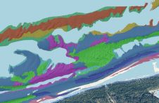
This article presents a novel methodological approach to understand and assess the suitability of airborne Lidar bathymetry for the automatic classification and mapping of the seabed. This solution allows recording of...
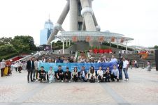
From 5-9 June, ComNav Technology's Annual Partner Conference 2023 took place in Shanghai, China. Some 30 global distributors from the UK, Japan, Australia, Guyana, Uganda and other countries gathered to...
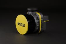
ROCK Robotic has announced the launch of its latest Lidar mapping system, the R3 and R3 PRO. The R3 product line introduces advanced hardware components into a lightweight, integrated 3D...
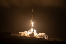
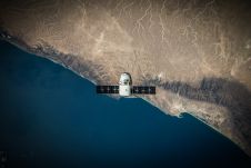
King Abdullah University of Science and Technology (KAUST) and its partner Spire Global have successfully launched a Cubesat satellite on the SpaceX Transporter-7 mission from Vandenberg Space Force Base in...
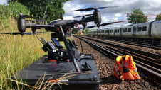
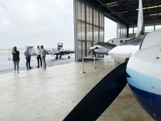
Plowman Craven has introduced Vogel Freedom, a UAV survey system designed for rail infrastructure surveying. Vogel Freedom is a survey-grade solution that surveys tracks without physical access. A novelty in...
This site uses cookies. By continuing to use this website, you agree to our Cookies Policy. Agree