Aerial mapping: time for more flexibility and standardization
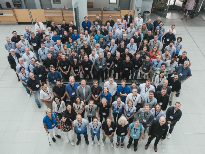
Open Day Photogrammetry 2023, Germany
What are the challenges of image-based data acquisition for photogrammetric mapping and mesh modelling? And how can photogrammetry be made accessible? The annual Open Day Photogrammetry provided some answers to these questions in early September 2023, with inspiring insights into sensor technology and plenty of engaging technical discussions in the beautiful German city of Münster.
Many people from outside the German-speaking region may not have heard of the Open Day Photogrammetry 2023; in German, it could be described as a Geheimtipp (a hidden gem). Held on 12 and 13 September at Münster/Osnabrück Airport – including social activities in the heart of Münster itself – the two-day event was an outstanding opportunity to remain at the forefront of photogrammetry-related innovations.
The theme for this year’s event was ‘Photogrammetry Made Accessible’. Attendees were given an exclusive glimpse into the world of aerial photogrammetry, gaining insights into the technology and engaging in discussions with manufacturers of both hardware and software. The event featured informative technical presentations and offered opportunities to participate in workshops covering image processing, flight planning and surveying.
Broad mix of stakeholders
What sets this event apart is its ability to bring together manufacturers, service providers and end users, such as federal states and cities – and particularly their specialized geodesy departments responsible for fundamental state surveying. Thanks to this broad mix of stakeholders, the event is a true reflection of how the aerial mapping industry works in practice, from start to finish.
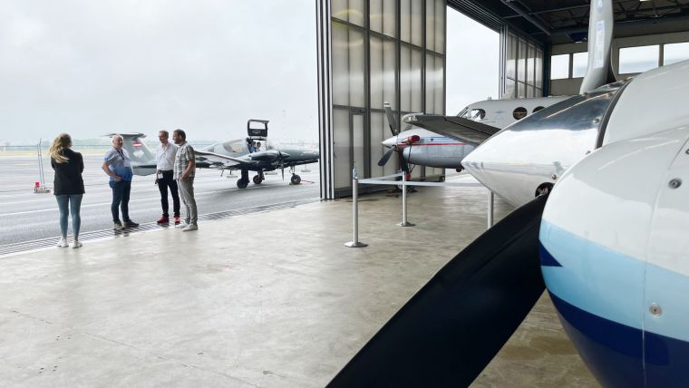
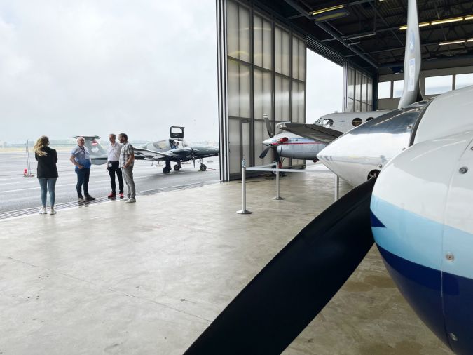
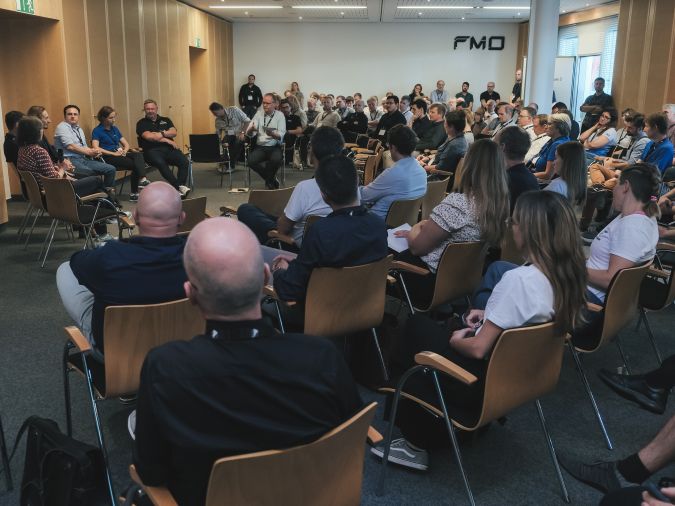
The event got off to an impressive start, with a display of aerial mapping aircraft and associated high-end sensor-based survey equipment on the first day. But another stand-out highlight was the lively fishbowl discussion on the theme of ‘Geodata in administration: acquisition and application’. One key subject was the role of the government in relation to the aerial mapping industry. The issue of bureaucracy was frequently raised – not only in the context of the numerous local and regional regulations that aerial mapping companies must comply with in order to carry out projects, but also the patchwork of rules and requirements at European level. Meanwhile, various participants in the discussion expressed their frustration at the continued lack of a level playing field to support fair competition in the sector.
Demanding customers
Another interesting phenomenon covered during the fishbowl discussion was the growing tendency for customers to make – sometimes unnecessary – demands. Michael Cramer, discussion moderator and a senior lecturer at the University of Stuttgart, questioned whether some customers are losing sight of the price/quality ratio in the tender process, instead focusing on quality alone. But does every application really need to deliver maximum precision or the highest possible quality?
Participants also highlighted that illegible and inconsistent Statements of Works (SOWs) – the essential project planning and execution documents outlining the tasks, deliverables, timelines, pricing and standard regulatory and government terms and conditions – lead to not only a lot of annoyance, but also a lot of unnecessary costs. To avoid reinventing the wheel every time, a little more cooperation between the various German authorities would help, it was concluded.
Impact of climate change
Next up for discussion was the impact of climate change on the aerial mapping market from the perspective of both sensor developments and costs. For example, adverse summer weather resulting from global warming is increasingly delaying projects and forcing mapping companies to extend their flying season into the autumn months. But how is that affecting the geodata quality, e.g. due to less light towards the end of year? Konrad Wenzel, director of Esri’s R&D centre in Stuttgart (which was founded ten years ago as nFrames), indicated that sensors have developed in such a way over the last decade that the collection of first-class data quality should no longer be a problem, although the conditions under which data is gathered do present some challenges. Although part of the solution lies on the software side in terms of editing the images so that they meet the required standards, the quality of the sensors (especially in combination with the atmospheric conditions) remains a point of attention. However, advancements in sensor technology are increasing the possibilities for mapping outside the traditional flying season.
Flexibility and standardization
Aicke Damrau, managing director of GeoFly, agreed with Wenzel that technological developments are opening up new possibilities for geodata quality, but also felt compelled to state that political decisions are still imposing limitations on the use of airspace. According to him, and his plea was supported by several other participants, it is time for more flexibility. This offers opportunities, because modern technology must ensure acceptable quality of aerial data, even under more challenging circumstances.
Engelbert Breg from Vexcel Imaging touched on several topics that were addressed throughout the two-day event when he called for a uniform Europe-wide description of every geospatial product (e.g. digital terrain model, digital elevation model, etc.). This would ensure that all products meet certain quality standards, and would also help in completing a European tender that does justice to the aerial mapping industry. The European Association of Aerial Surveying Industries (EAASI) was identified as the ideal organization that can include the most important discussion points as key takeaways in their activities.
Strengthening the sector’s profile
The Open Day Photogrammetry 2023 featured too many interesting presentations and workshops to cover in detail here, including crowdsourced processing of geospatial data, artificial intelligence in photogrammetry, and the launch of the IGI Ecomapper). But for me, one of the key takeaways is that the aerial mapping industry (and actually the mapping and surveying sector as a whole) often sees itself as being small, yet it is so important. As one of the speakers pointed out, 80% of all decisions are based on geodata. The message is clear: the sector stands to benefit from strengthening its profile. Needless to say, at GIM International we are willing and able to play a part in this!
After my debut in Munster, I can wholeheartedly say that I am eagerly anticipating the Open Day Photogrammetry 2024, which will mark its fifth edition. I have even heard rumours that the 2024 edition is set to take place further south in Germany, adding to the excitement! More information is likely to follow within due time.
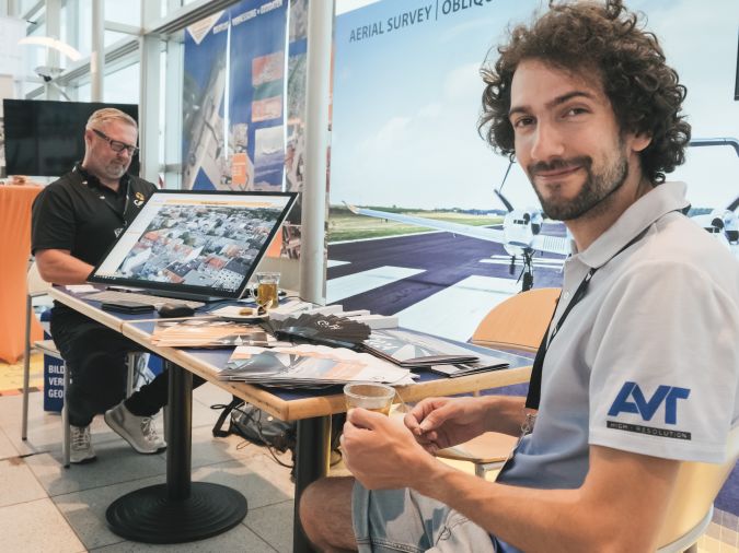
Open Day Photogrammetry 2023 was organized by the following companies: AVT Airborne Sensing, GeoFly, BSF Swissphoto, Geoplana and Aerowest. The event organizers kindly provided most of the images featured here.

Value staying current with geomatics?
Stay on the map with our expertly curated newsletters.
We provide educational insights, industry updates, and inspiring stories to help you learn, grow, and reach your full potential in your field. Don't miss out - subscribe today and ensure you're always informed, educated, and inspired.
Choose your newsletter(s)


