Mapping and 3D Modelling in Medina
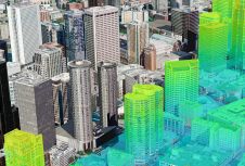
The city of Medina in the Kingdom of Saudi Arabia is realising base maps and 3D modelling. In order to provide the necessary services, Blom CGR, the Italian subsidiary of...
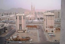
The city of Medina in the Kingdom of Saudi Arabia is realising base maps and 3D modelling. In order to provide the necessary services, Blom CGR, the Italian subsidiary of...
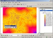
SuperGIS Spatial Analyst 3 is a spatial processing tool working with SuperGIS Desktop 3.1 to complete advanced spatial analyses and tasks. Designed for deriving information from geo-applications, it provides users...
The LFM User Meeting Europe 2011 will be held on Thursday 10th November at the World Forum, The Hague (The Netherlands). This follows on directly from the SPAR Europe conference...
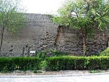
The Great Wall of China is one of the largest manmade wonders of the world, comprising many different and irregular structures. We employed airborne Lidar to produce highly accurate digital...

Newcastle University, UK, is developing advanced computer modelling to assess the flood risk of individual properties using Lidar data and oblique aerial photography from Bluesky. The project will use artificial...
A seminar on 3D urban modelling and ways in which it can be implemented into your working life is being organised by aerial photography company Getmapping. Held at Bath Spa...
The Miage Glacier at Mont Blanc Massif, with an area totalling 11km2, is the third largest glacier in Italy. Time-space modelling of the lakebed and glacier walls carried out with...

Pix4D will be hosting its flagship conference in Denver, Colorado, on 13 October 2022. The event includes expert guest speakers on 3D modelling and photogrammetry, personal consultations, networking opportunities, the...
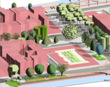
How does 3D city modelling fit within the context of broader developments such as smart cities and digital twins? And which six challenges must be overcome before 3D data as...
How can we address the need for frequent large-scale mapping in order to model real-time change? In this column, John Welter, president of geospatial content solutions at Hexagon Geosystems, zooms...
This site uses cookies. By continuing to use this website, you agree to our Cookies Policy. Agree