Flood Risk Modelling Using 3D Aerial Survey Data
Newcastle University, UK, is developing advanced computer modelling to assess the flood risk of individual properties using Lidar data and oblique aerial photography from Bluesky. The project will use artificial intelligence to extract information from other datasets, including old reports and flood asset registers, and bring this together with weather and traffic sensors, for example, to provide a dynamic online platform for hyper-local, near-real-time flood risk assessments.
Providing real-world context and accuracy, the Bluesky data enables visualization of evolving events that will allow flood risk managers to employ just-in-time maintenance and alleviation methods, such as clearing blocked drains or setting up mobile defences.
“In 2012 Newcastle experienced the worst flooding in living memory,” commented Dr Luke Smith, a lecturer in data-centric civil engineering and deputy director of the Urban Observatory at Newcastle University. “Referred to as 'Thunder Thursday' and the ‘Toon Flood’, this exposed a number of weaknesses in our existing flood modelling. We are, it would appear, incredibly good at predicting what roads will flood but not always the consequences for infrastructure, transport and individual homes."
Combining Lidar and photogrammetry
“The Bluesky MetroVista data combines Lidar and photogrammetry, providing accuracy and detail that enable us to include information that is simply not available from a single source,” he continued. “For example, as part of this project we will consider the impact of property age and type of construction, we can look at the permeability of a house’s front garden and sometimes even door thresholds – all important considerations in flood risk assessment and mitigation at this scale.”
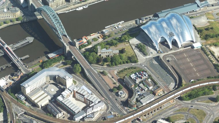
The Bluesky data is part of the MetroVista product range, which uses new aerial mapping technology to simultaneously capture vertical and oblique photography together with laser-scanned height measurements. In addition to the Bluesky data, the PYRAMID (Platform for dYnamic, hyper-resolution, near-real-time flood Risk AssessMent Integrating repurposed and novel Data sources) project will use brand-new information from a range of sensors deployed as part of the University’s Urban Observatory. The project will also use artificial intelligence and machine learning to automatically extract information from other data sources.
Captured using a large-format imagery and Lidar hybrid airborne sensor, the Bluesky MetroVista imagery collection includes simultaneously captured oblique and vertical aerial photography. The MetroVista datasets also include geographically accurate, phototextured mesh models ready for use in 3D GIS, CAD and other modelling software as well as visualization, gaming and virtual reality workflows.

Value staying current with geomatics?
Stay on the map with our expertly curated newsletters.
We provide educational insights, industry updates, and inspiring stories to help you learn, grow, and reach your full potential in your field. Don't miss out - subscribe today and ensure you're always informed, educated, and inspired.
Choose your newsletter(s)


