Found 2763 results
Sort by

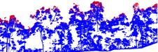
Laser Scanning Technology Challenged

In this month’s Insider’s View Prof. Heinz Rüther puts some critical points on the shortcomings of laser-scanning technology in the spatial documentation of heritage sites. We invited manufacturers of laser-scanning...

Read more

Portable Laser Scanning System

3D Laser Mapping (UK) has developed a portable laser scanning system for mapping overhead infrastructure such as power lines. With adverse weather and over-grown vegetation increasingly causing damage to overhead...

Read more

Mobile Laser Scanning Point Clouds

The demand for 3D maps of cities and road networks is steadily increasing and mobile mapping systems are often the preferred acquisition method for capturing such scenes. Manual processing of...

Read more

Mobile Laser Scanning Point Clouds

The demand for 3D maps of cities and road networks is steadily increasing and mobile mapping systems are often the preferred geodata acquisition method for capturing such scenes. Manual processing...

Read more