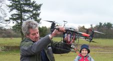
Captivated by Technology and a Skateboard - Leica Roadshow 2015
Twickenham Stadium, the home of rugby, was the venue for the final date for this year’s Leica Roadshow. As ever, a keen crowd heard the company’s experts talking about the...

Twickenham Stadium, the home of rugby, was the venue for the final date for this year’s Leica Roadshow. As ever, a keen crowd heard the company’s experts talking about the...
Archaeology entails the recording of the physical remains left by past generations. Traditionally, archaeological exploration has been by excavation. Other survey techniques have recently gained importance in recording remains that...
Today’s geodata acquisition technologies combine microprocessors, computer power, solid state drives, complementary metal-oxide-semiconductor (CMOS) sensors, miniaturisation and many more developments. But demand is just as important as supply, and demand is...
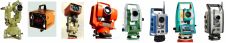
A total station is an angle measuring device, also known as a theodolite, integrated with an electronic distance measurement (EDM) unit. The integration provides the ability to measure horizontal and...
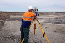
What is the current status of surveying in the mining industry, and which types of survey equipment and technologies are being used today? Geospatial data forms the foundation of mining....

Digitalisation and new technologies with the ability to revolutionise the geospatial industry are creating a new playing field for mapping and surveying professionals. This evolving landscape is also reshaping the...

This month the focus is on training, education and encouraging young people to enter our profession. When I was not long into the profession, I remember sitting for my first...
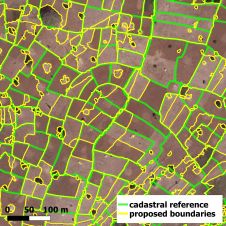
How can the mapping of land tenure be automated to support the shift towards cadastral intelligence: the integration of human-based expert knowledge with automatically generated machine-based knowledge? The inability to...

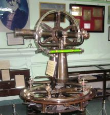
Did you know that surveyors have been indispensable to the development of the world since civilization began? John F. Brock takes us on a brief journey through the history of...
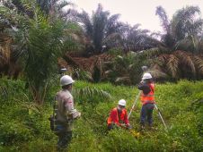
The latest GNSS technologies from CHCNAV have been used in combination with vocational training on the island of Sumatra to improve the productivity of surveying activities and hence contribute to...
This site uses cookies. By continuing to use this website, you agree to our Cookies Policy. Agree