3D Cadastre in Victoria Australia
Converting Building Plans of Subdivision
Three-dimensional (3D) land development is common, especially in urban areas. Management of 3D land rights, restrictions and responsibilities (3D RRRs) is one of the most important challenges in current land-administration systems, most of which are equipped with cadastres able only to maintain information in a 2D spatial information environment.
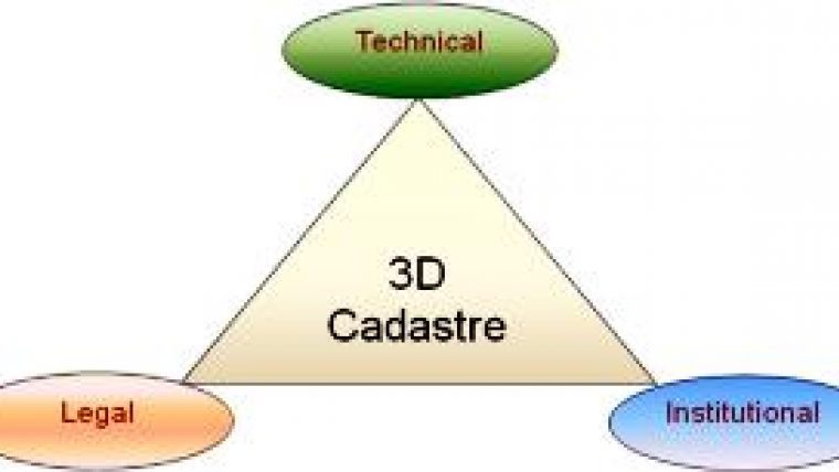
Assistance in the management of 3D RRRs would come with 3D cadastre. A 3D cadastre should be capable of storing, manipulating, querying, analysing, updating and visualising 3D cadastral objects and their associated land rights, restrictions and responsibilities. 3D cadastral aspects should be considered for any modern system, and several provide a framework for its successful development and implementation. Firstly, legal support in defining 3D property rights, registration and representation of 3D properties; secondly, institutional support in the form of regulations for acquisition of 3D data, and the tasks and responsibilities of public and private sectors; and thirdly, technical help in 3D data capturing, modelling, representation, and updating.
Research Centre
The Centre for SDIs and Land Administration (CSDILA) at the University of Melbourne undertakes research in 3D cadastres. It recently received funding (2011-2014) from the Australian Research Council (ARC) linkage programme and industry partners to investigate the development of 3D cadastres, and land and property management. The project attracts industry partners in government and the business sector, including Land Victoria, Department of Sustainability and Environment (DSE); Land and Property Management Authority NSW; Intergovernmental Committee on Surveying & Mapping (ICSM); PSMA Australia Ltd; Vekta Pty; Alexander & Symonds; Fender Katsalidis Architects; and Owners Corporation Victoria.
This research aims to deliver:
- improved understanding of problems and issues associated with incorporation of third dimension in cadastre
- specification of policy, legal, institutional and technical aspects of 3D cadastre
- a 3D cadastral data model
- a 3D cadastral database management system
- a 3D cadastral representation model
- a 3D cadastral registration model
- prototype 3D cadastral system and associated applications.
As part of the project, current practice of 3D registration in Victoria is under assessment as a first step towards research strategic planning. This assessment is designed to check the legal, institutional and technical aspects of a 3D cadastre in Victoria.
Various Aspects
Property legislation in Victoria developed after the 1850s in response to demands for multiple ownerships of land and buildings. Legally, up until the Subdivision Act 1988, various Acts and regulations were intermittently introduced to legislate for the ownership and securing of 3D properties. In modern form these included the Local Government Act 1958, Transfer of Land Act 1958, Property Law Act 1958 Transfer of Land (Stratum Estate) Act 1960, Strata Titles Act 1967, Cluster Titles Act 1974 for freehold lands and Land Act 1958 for crown lands. Victoria's current legislation allows owners and developers to register 3D properties. However, depiction of 3D rights, restrictions and responsibilities remains complex and difficult for the public to understand.
Common Viewpoint
From the institutional side, as shown in Figure 2, there should be a close and consistent relationship between public and private sectors to facilitate sharing of knowledge and to reach a common viewpoint on the concepts and principles for development of a 3D cadastre.
Technical aspects of the 3D cadastre vary according to content and can be categorised under different subjects based on their objectives. They are 3D data capturing (types of 3D cadastral objects), 3D data representation (visualising 3D cadastral objects), cadastral updating, and 3D data modelling.
Current Practice
Victoria's land administration system typically comprises the textual and spatial components of 2D spatial and non-spatial information. A plan of subdivision is used to show the layout of lots (land, building, air space) and to provide all necessary information about the development, such as easements. The plan must show cross-sections when any parts of lots, common property, roads or reserves are located above or below other parts. These cross-sections show the upper and lower limits of parcels, the storey or level on which the parcels are situated, and stairs, balconies or other features where appropriate. The selection of what type of side view (or elevation) is shown depends both on circumstances and personal preferences.
The digital cadastral map in Victoria is based on land parcels. Properties above or below ground level are not recorded on the cadastral map. However, tunnels and other underground structures may be so recorded. As can be seen in Figure 3a, the southern part of the University of Melbourne city campus (University Square) is surrounded by buildings and also has an underground car park. The digital cadastral map (Figure 3b) represents 2D information.
3D property information is reflected in plans of subdivision in the Land Registry, but 3D properties are not represented on cadastral maps and in the digital cadastral database (DCDB). For tunnels and bridges, Land Victoria provides a limited presentation of 3D data in the DCDB.
Since current practice of 3D representation relies on a 2D plan, further improvement can represent 3D properties more adequately and effectively.
Analysis of current practices of 3D representation in Victoria identifies complexities found in different types of plans in terms of 3D and vertical information. These include:
- vertical information only exists in cross-sectional diagrams
- location of cross-sections depends on surveyor's decision and is not standardised
- plans are paper-based and cannot adequately represent 3D structure
- determination and measurement of dimensions, area and volume from these plans is difficult
- many separate pages of plans are required to depict even a simple 3D property
- interpretation of these plans is complex, time consuming and requires expertise
- plans do not support additional non-spatial information such as texture and colour
- paper plans do not support 3D analysis
- some rights, restrictions and responsibilities cannot be spatially represented in the plans.
Overall, improvements are essential if 3D plans of subdivision are to be capable of representing the actual 3D situation. Although this registration method is effective for registering and securing 3D properties in Victoria, the 3D cadastre could improve, represent and manage 3D properties and additionally create 3D visualisation possibilities. 3D analysis would also operate on 3D data to perform different applications.
Prototype System
In order to better understand the complexity of issues associated with 3D property management and buildings, the research team developed the first 3D-Cadastre prototype system for Victoria, utilising a variety of technologies. The prototype system includes conversion of a Victorian subdivision plan consisting of 3D buildings, easements and common property. In developing the prototype system the subdivision plan was analysed and modelled in accordance with the requirements of electronic surveying and subdivision plans (ePlan) developed by the Intergovernmental Committee for Surveying and Mapping, Australia. The prototype system utilises the LandXML data format for storing 3D cadastral information. This is the first attempt to use the LandXML data format for 3D cadastral data modelling. LandXML was designed primarily for data transfer purposes and does not cater for visualisation functions.
Given limited LandXML features for visualisation, the 3D subdivision plan was converted to KML, Google Earth's native data format for visualisation purposes. The research team developed a web service that converts a 3D LandXML file into an equivalent version in 3D KML which then can facilitate visualisation of the object, in this case a building. A screen shot of the prototype system is presented in Figure 4.
Concluding Remarks
3D cadastre and property management are important and strategic components of Australian land registration, planning and development. Historically, property legislation met the demands for 3D registration in Victoria and forced the representation of the third dimension in cross-sections on the paper-based plans of subdivision. The trend in both public and private sectors is now toward the development of the 3D cadastre. However, some technical obstacles to development and implementation of the 3D cadastre remain. Assessment of the underground car park, a relatively simple facility, showed that the existing plans were insufficient for identifying 3D objects. Vertical information does not exist in all subdivision plans (building subdivisions). Non-spatial information such as colour and texture of walls cannot be identified by these plans.
The 3D project will soon be supported by a dedicated website which will communicate the progress of the research. For more information, visit the Centre for SDIs and Land Administration website (1).

Value staying current with geomatics?
Stay on the map with our expertly curated newsletters.
We provide educational insights, industry updates, and inspiring stories to help you learn, grow, and reach your full potential in your field. Don't miss out - subscribe today and ensure you're always informed, educated, and inspired.
Choose your newsletter(s)


