Apps for Land Administration
Exploring the Needs, Options and Future Developments
The use of community participation, mobile technologies and cloud storage services could create a new way of undertaking land administration activities, and ultimately lead to more secure land rights for all. Sparked by these grand visions – which were first promoted by Robin McLaren, amongst others, in the late 2000s – alternative land administration platforms are now emerging, such as cadasta.org, landmapp.net and mobineo.org to name but a few. Apps lie at the heart of the developments…but what do we really mean by a ‘land administration app’ and what must such an app be capable of? Here, the authors provide a brief overview.
Exponential Uptake
New-era land administration calls for approaches that are ‘fit-for-purpose’, ‘pro-poor’ and supportive of a ‘continuum of land rights’. Deeper exploration of these concepts shows that mobile devices are ready-made support tools. In the hands of a responsible operator – and loaded with the right apps – information about people, rights and land can be created quickly. The technology, especially the so-called smartphone variety, is technically robust, computationally powerful, functionally flexible, relatively cheap and increasingly available and accessible to all – even to those often considered socially, politically or economically marginalised. These features and characteristics will only further increase over time.
Guiding Principles
Pro-poor and fit-for-purpose criteria, respectively outlined by the Global Land Tool Network (GLTN) and the International Federation of Surveyors (FIG), can be used to provide guidance on the capabilities of an app for land administration. The pro-poor mindset demands affordability, transparency, accessibility, equitability, registration of all types of rights, and recording of secondary rights and complex rights. But it also requires simplicity, quick recording techniques, minimal costs, reproducibility and relevance. Less focus is placed on spatial accuracy. Likewise, the fit-for-purpose approach demands affordability, reliability and inclusiveness. In addition, flexibility (in data capture approaches), attainability, participation and upgradability are necessary.
Essential Criteria
The guiding principles can be converted into essential app criteria. Based on feedback from key informants from within the global land administration sector, from the perspectives of accessibility, availability, functions and technical features a land administration app should: be equally accessible amongst all the beneficiary groups; be affordable for those beneficiary groups; create the opportunity for recording varying tenure types (including customisable attributes); have the ability for the inclusion of different languages; have functionality for different land administration processes; require operators to have little to no programming skills; require operators to have little to no training; have extremely simple user interfaces; enable online and offline availability; have low-bandwidth requirements (for online); allow the opportunity to record multimedia content (particularly imagery); have openness to storing common and open-data formats (SHP,KML, CSC); allow for back-end cloud selection; allow for the provision of varying base layers (orthophotos, satellite imagery or free layers); have the ability to capture and work in local and global coordinate systems; allow data storage in local or remote databases; support standardised and custom-built data models; have the possibility to be installed on different operating systems; and have the ability for external device connectivity (e.g. higher-grade GNSS).
Off-the-shelf
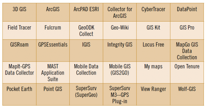
Taking the above into account, a considerable number of ‘off-the-shelf’ apps already exist: more than 30 different offerings (Table 1). These are capable of supporting parts of a land administration workflow, but are not designed specifically for it. The ‘off-the-shelf’ apps are usually generalised spatial data collection apps that are capable of data collection, storage, mapping, navigation and inheritance of different roles. They can collect coordinates, but also multimedia data including textual attributes, audio, imagery and video. Examples include: ‘Collector for ArcGIS’, ‘Locus Free Pro’, ‘MapIt-GPS Data Collector’ and SuperGeo’s ‘SuperSurv’ and ‘GeoODK’.
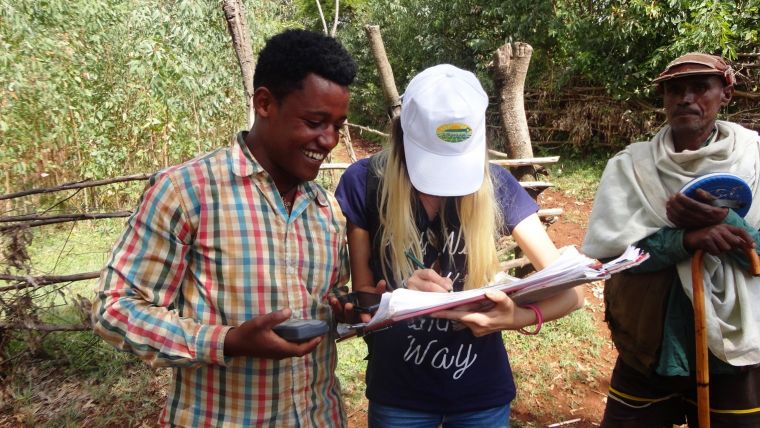
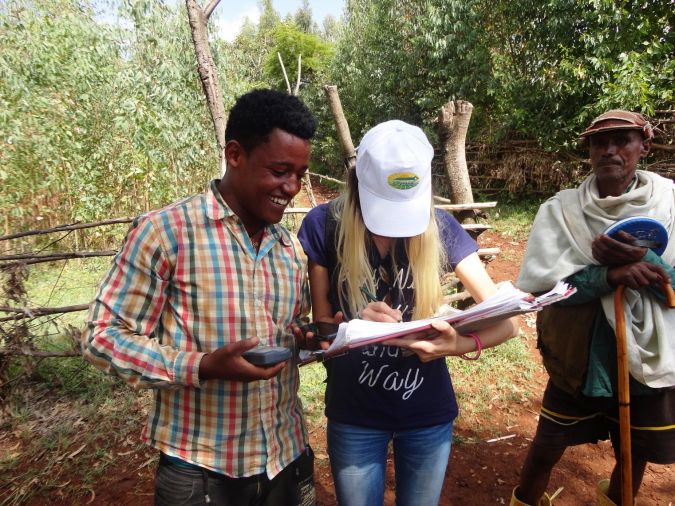
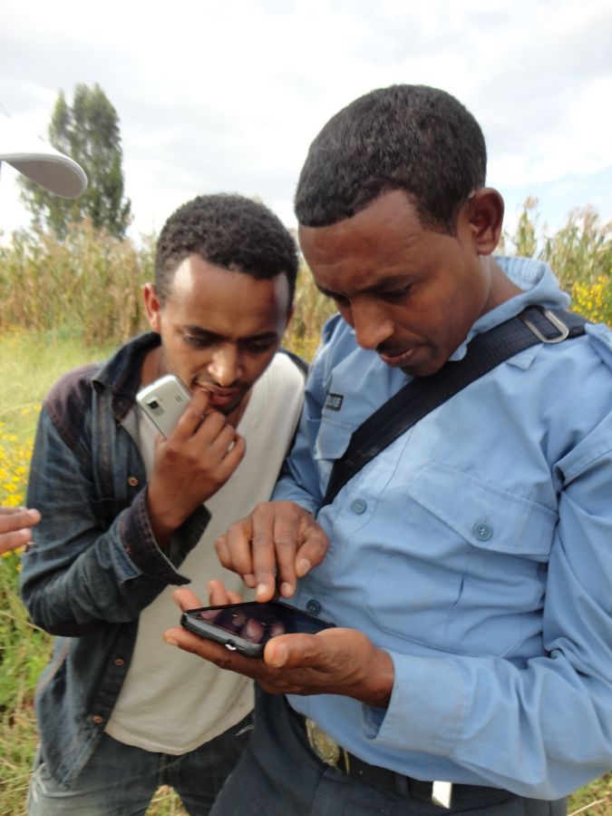
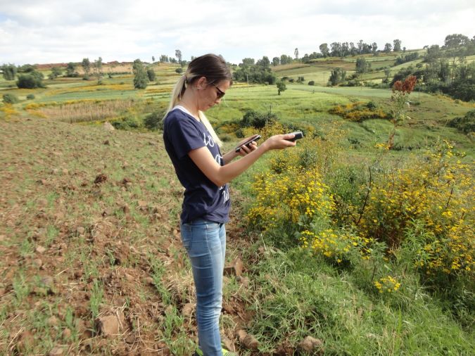
Only a few of these have been tested for land administration, particularly in terms of functionality, processes, data quality and social acceptance. The November 2015 edition of GIM International previously reported on a simple yet successful pilot demonstration conducted using mobile devices, including Esri’s ‘Collector for ArcGIS’, and linkage to Trimble R1s (for improving spatial accuracy) in Colombia. A similar trial has been run using the same app/tool combination, with apparent technical success, in the Amhara region of Ethiopia in 2015. Such investigations show that there are key differences and choices in terms of usability, extendibility, functionality, back-end support, costs (free vs. one-off vs. subscription), spatial accuracy and offline functionality. In short, some apps appear more ready to support land administration activities than others – although ‘where’ one wishes to undertake land administration work could have a significant bearing on choice. In addition, none are really designed for non-professional users and they all have limited customisation options.
Made-to-order
More recently, apps (and/or supportive platforms) built specifically for land administration requirements have emerged: cadasta.org, mobineo.org, landmapp.net, FAO’S Open Tenure and USAID’s ‘MAST Application Suite’ are just some examples. Often coming complete with significant donor backing, supportive organisational structures, back-end cloud capabilities and differing business models, these offerings seek to provide responsible end-to-end – or beneficiary-to-database (or certificate) – land administration support. The focus is particularly on contexts where land rights recording is incomplete, regarded as too time-consuming, lacks transparency or is in a state of decay. Some take a commercial approach, whilst others have a not-for-profit mindset. Although all are currently in the early stages of R&D or advanced piloting, scaled implementation is the end goal. Time will tell which business and technical arrangements are sustainable in the longer term.
Future Developments
With the growing mix of off-the-shelf and made-to-order land administration app offerings, the land sector and land professionals have an increasing number of options when undertaking the fit-for-purpose or pro-poor parts of their work. It can be assumed that these offerings are only going to improve in terms of adherence to the guiding principles and essential criteria. Whilst a very small snapshot of developments is provided here, it seems a GIM International ‘apps for land administration’ product survey, or Geo-matching.com equivalent, could provide a useful update on this highly dynamic and ever-growing part of the land sector.
Further Reading
Light Mobile Collection Tools for Land Administration, GIM International 11, 2015

Value staying current with geomatics?
Stay on the map with our expertly curated newsletters.
We provide educational insights, industry updates, and inspiring stories to help you learn, grow, and reach your full potential in your field. Don't miss out - subscribe today and ensure you're always informed, educated, and inspired.
Choose your newsletter(s)


