Digitizing Hydrocarbon Storage Tanks
An Efficient and Safe Pre-maintenance Analysis
Carrying out essential maintenance on storage tanks can be complex. This case study outlines how a 3D topographic tank survey enabled identification of which areas of the tanks required maintenance. After capturing an image of the tanks with a laser scanner, the geospatial data was visualized, resulting in the full project as a digital twin. This project is an example of how technologies are changing the traditional approach to surveying techniques.
The API Refinery of Ancona SpA is a petrochemical plant located along the Flaminia Route in the seaside resort of Falconara Marittima, Italy. Built on an area of 700,000 sq. m in 1950, the plant currently has a processing capacity of 3.9 million tonnes per year – the equivalent of 85,000 barrels per day – and a storage capacity of more than 1.5 million cubic metres.
The refinery separates crude oil – a mixture of mostly paraffinic and naphthenic hydrocarbons of different molecular weights – into its components, the so-called ‘splits’. These are treated in a series of successive processes to obtain different commercial products. The semi-finished or final material is then stored in tanks, which require regular cleaning and maintenance because of the special nature of the materials stored and their vast size. The refinery is also equipped with a land shipment system that has a capacity of about 12,000 tonnes per day and a sea reception system with marine terminals for oil tankers up to 400,000 tonnes.

Scanning the storage tanks
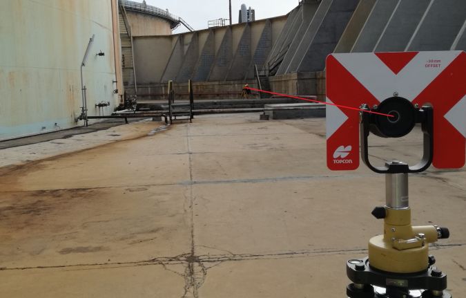
When it came to carrying out essential maintenance on the storage tanks, which can often be complex, contractor Paresa SpA worked closely with Topcon Positioning Group to conduct a topographic survey using a three-dimensional analysis of the tank. The Topcon GLS-2000 laser scanner was chosen for the job due to its ability to reconstruct the entire structure and all of its features. Topcon’s MAGNET Collage was then used to process the data and visualize the project in 3D.
The TK 62 hydrocarbon storage tank has an inner diameter of 96 metre and an average shell height of approximately 22 metre. The shell consists of ten rings of circumferential sheets, or ferrules, which vary in thickness, starting from 46mm at the bottom to 12mm at the top. The plates of these circumferential rings are superimposed with respect to the central axis. The shell is stiffened by an angular crowning profile and a circumferential walkway, which can be walked on throughout its entire length.
Speeding up the process
Contractor Paresa decided to carry out a 3D topographic survey of the tank, using the Topcon GLS-2000 laser scanner. The survey was carried out in close collaboration with Topcon specialists from the Ancona office, who provided the necessary technical support to Paresa staff involved in the operations on-site.
The GLS-2000 is a full-featured scanner that can be effectively deployed to capture existing, as-built conditions for any application range. The compact, lightweight scanner accurately captures a full 360° scan, including images, in less than three minutes. Marcus Delfino, business development manager Vertical Construction & UAV, commented: “The scanner works by measuring thousands of points per second, describing the surface of the scanned object through point clouds. Each scan is a separate survey that must then be put in spatial relation with the other scans in order to create final, complete and noise-free data.
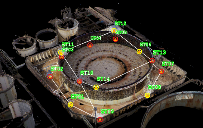
“One of the characteristics that distinguishes the Topcon laser scanner is the topographic base formed by the polygon. In this case, this means that 14 laser scanner stations already aligned by topographic traverse are returned to the reference system of the project by fixing two points - initial and final to the polygon – detected directly by the laser scanner. Moreover, the laser scanner station points can be reused during subsequent tests or future maintenance as survey benchmarks.”
Giovanni Salvucci, project manager at Paresa, said: “The GLS-2000 scanner enables 360-degree scans to be captured quickly and accurately, helping us to easily identify which areas of the tanks required maintenance. Essential maintenance is carried out on the storage tanks every five to ten years, so it’s important that this is completely accurate. The scanner helped to make the complex process as simple and efficient as possible.”

Creating a digital model of the tank
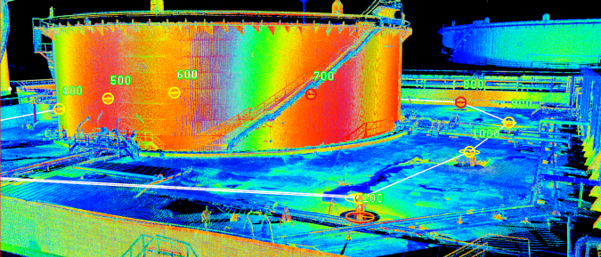
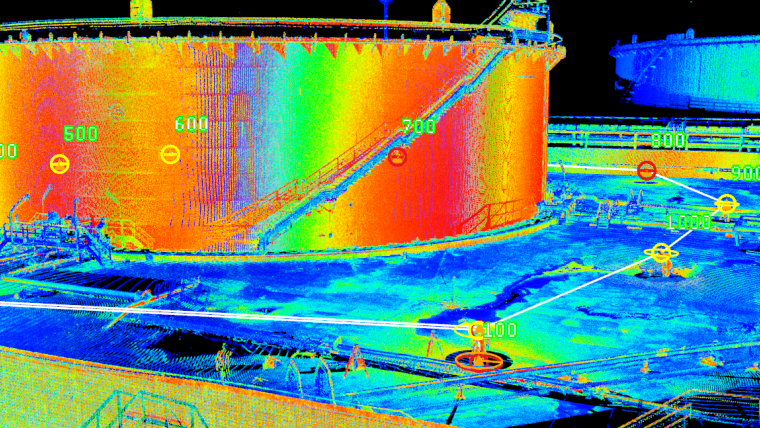
The processing of the data extracted from the laser scanner survey was entrusted to independent architect-engineer and BIM specialist Maria Giulia Salvucci who, as part of the technical-dimensional verification of the TK 62 tank, was asked to analyse the state of deformation for verticality, ovality and flatness. Maria said: “The discrete point cloud was processed using MAGNET Collage to obtain numerical values of deformations suffered by the tank in terms of ovalization, seabed subsidence and alteration of verticality. This type of analysis made it possible to quantify all the deformation states of the object to one-millimetre accuracy, which can be compared with a grid that describes the geometry of construction of the tank itself.”
Using MAGNET Collage, the user is able to produce and export cross sections of the areas they want to inspect in the tank. Maria added: “This process is a real technical screening of the tank that allows the design of properly targeted, high precision maintenance. Constant monitoring and analysis of the spatial variations of the points can also be carried out over time. Using MAGNET Collage helped to visualize the data and see the full project in 3D. I didn’t go on site myself, which can sometimes make it more difficult to interpret the data and visualize the project, but using MAGNET helped me to study the data like I was in the field – from my office.
“The software also helped to dramatically decrease the time it took to process and analyse the data. It usually takes us about a week to reconstruct the layout and complete the report, but with MAGNET Collage we were able to do this in just half the time. This is the first project that we used the GLS-2000 and MAGNET Collage software on, and now we are using it on other projects to help us to address many problems.”
Giovanni Salvucci concluded: “The development of these technologies has changed the traditional approach to surveying techniques. Adopting digital processes such as BIM means we’re able to reduce errors in the design and verification phase, and it makes it possible to verify work in progress. Companies that want to keep up must innovate and improve product quality, so adopting this new approach is vital.”


Value staying current with geomatics?
Stay on the map with our expertly curated newsletters.
We provide educational insights, industry updates, and inspiring stories to help you learn, grow, and reach your full potential in your field. Don't miss out - subscribe today and ensure you're always informed, educated, and inspired.
Choose your newsletter(s)


