European aerial surveying industry gathered at the 2022 EAASI Summit
Event in Rome attended by more than 70 representatives from 40 companies
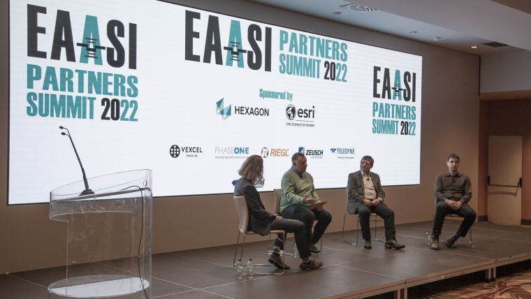
More than 70 members of the aerial mapping industry attended the fourth EAASI Partners Summit from 30 November to 2 December 2022 at Hotel Vila Pamphili in Rome. Over the course of three days, they participated in a series of presentations, panel discussions and workshops covering a wide range of topics related to the trends, challenges and opportunities of aerial surveying.
The aerial surveying industry has been facing a changing reality during the last few years. The European Association of Aerial Surveying Industries (EAASI) was born to foster collaboration among all the companies involved in generating geodata from manned airborne platforms. Membership of EAASI is open to aerial survey companies, equipment manufacturers, software developers and service providers from within the aerial surveying industry across Europe.

The Partners Summit is organized every year as an opportunity to meet, discuss and analyse the complex reality of the aerial surveying industry today. The summit also provides a networking platform and facilitates service providers meeting with end users and manufacturers in a relaxed and sociable atmosphere. The 2022 edition marked a new record of attendance, with more than 70 representatives from 40 companies participating.
The programme included keynote speakers from the European Commission, the Food and Agriculture Organization of the United Nations, and industry leaders in high-resolution 3D models, airborne imaging, Lidar solutions, airborne scanning and aircraft solutions. The venue and timing of the 2022 EAASI Summit made it a special conference that combined professional presentations and a networking environment with a relaxed atmosphere in the magnificent city of Rome.

The future of the industry: trends, challenges and opportunities
In his opening speech, Simon Musäus, EAASI president, elaborated on the value of agility in business models and cooperation to achieve the association’s number one goal: sustainability of aerial surveying. He thanked the secretary-general and board members for their efforts and highlighted the creation of new partnerships with other stakeholders within the geospatial field, such as EuroSDR, EuroGeographics, EUROGI and the UN-GGIM PSN. As a particular focus point, he called for a continuation of the increased representation at key events (Geospatial World Forum, FIG Congress, Intergeo) to promote the association’s role and describe the critical contribution of aerial surveying in all areas of the economy.
Furthermore, a panel of experts moderated by Ed Parsons (Google) talked about the new trends and business opportunities in high-resolution 3D models based on aerial survey data. The speakers represented the industry leaders in processing advanced 3D city models as a basis for digital twins: Esri, Melown Technologies (part of Hexagon) and Skyline Software.

Aerial datasets and climate change
One of the key topics of the summit was sustainable development and how aerial surveying can contribute to monitoring climate change. In this regard, Simon Kay, deputy head of unit at the European Commission’s Directorate-General for Climate Action (DG CLIMA) presented the first EU-wide voluntary framework to reliably certify high-quality carbon removals. The proposed regulation will significantly improve the EU’s capacity to quantify, monitor and verify carbon removals. Higher transparency will ensure trust from stakeholders and the industry, and prevent greenwashing. According to Kay, the aerial surveying industry can make a significant contribution to this. “Accurate monitoring is where industries like your own play a part and will play an increasing part in the legislation that has been agreed,” he said. “Obtaining climate-relevant data compatible with digital maps will also significantly contribute to improving the quality of national greenhouse gas inventories for the land use, land-use change and forestry (LULUCF) category and improve the quality of forest monitoring activities in line with the upcoming proposal for a regulation on forest monitoring,” added Kay. In fact, aerial datasets can play a vital role in quantifying carbon removal activities and in developing new certification methodologies required by the new regulation.
Inge Jonckheere from the Food and Agriculture Organization of the United Nations (FAO) gave an insight into the geospatial work done by the UN in forestry. She also explained how remote sensing is used in developing forest inventories and tracking the loss of forest areas in line with the Sustainable Development Goals (SDGs) and the United Nations Framework Convention on Climate Change (UNFCCC).

Gender and diversity
The need for the aerial surveying industry to promote gender equality and diversity was mentioned several times during the summit. The geospatial field is at present a male-dominated industry and the presence of women remains low, particularly in sectors such as aerial surveying. Rachel Tidmarsh, managing director of Bluesky and EAASI treasurer, introduced the Women+ In Geospatial initiative aimed at promoting diversity and gender equality in the geospatial industry and academia. The mission of this worldwide professional network is to build an inclusive global community inspiring, uniting and empowering all ‘women plus’ in the geospatial sector to become strong leaders and changemakers.

How to attract new talent
The summit offered several occasions to discuss the current challenges of the industry and the next steps for the future. The participants exchanged their views and shared knowledge about this topic in three different workshops: one about the aerial surveying industry’s challenges, a second about certification and standardization, and a third workshop focused on how to address the external view of the industry and raise its visibility. Universities can play an important role in overcoming some of these challenges, and EAASI intends to collaborate more actively with them, particularly in the area of standardization of aerial datasets.
Furthermore, one of the industry’s recurrent issues is the struggle to attract new talent. EAASI is working to raise awareness about the exciting opportunities that aerial surveying offers and in this context it is strengthening its alliances with student organizations, universities and research institutions, as well as with networks of young professionals.
Stronger together
“The 2022 EAASI Partners Summit had a record attendance, which shows that the aerial surveying industry in Europe is very keen on collaborating to move forward and adapt to new realities,” said Marcos Martínez-Fernández, secretary general of the association. “EAASI has been working hard since 2019 to promote aerial mapping and represent the industry in the relevant forums. The summit offers an excellent opportunity to exchange views, plan the association’s next steps and engage in discussions about the current challenges and opportunities, as we have participants from all the components of the value chain. All companies showed a great interest in cooperation. I hope this interest translates into more active participation in the different activities and working groups we have at EAASI.”


Value staying current with geomatics?
Stay on the map with our expertly curated newsletters.
We provide educational insights, industry updates, and inspiring stories to help you learn, grow, and reach your full potential in your field. Don't miss out - subscribe today and ensure you're always informed, educated, and inspired.
Choose your newsletter(s)


