Fixed-wing UAS
Monitoring a Nuclear Power Plant Construction Site
Monitoring a nuclear power plant construction site requires regular collection of site data; even up to weekly coverage may be necessary. Conventional photogrammetry and land surveying are often too costly. The author shows that UAS technology based on a fixed-wing aeroplane enables weekly coverage of a 150-hectare construction site. The orthomosaics, digital elevation models, maps and 3D models generated from the imagery support site monitoring beyond expectations, while new applications are being found all the time.
Hinkley Point in Somerset, UK, is one of eight nuclear power stations owned and operated by EDF, a wholly owned subsidiary of France-based EDF Group which is one of the three largest energy companies in Europe. The company generates around one fifth of the UK’s electricity, and supplies electricity and gas to about 5.5 million customers in the UK. As eight power stations are scheduled to close by 2023, the UK is facing an energy shortage. In view of this, EDF, in concert with the British government, has identified Hinkley Point as a suitable site for building a new nuclear power station.
Site
Designated ‘Hinkley Point C’, the new plant will be constructed immediately to the west of the existing Hinkley Point B, which was built 38 years ago and is due for decommissioning in 2023. Hinkley Point C will be the first nuclear power plant to be built in the UK for 25 years. Two nuclear reactors will be constructed on the site, which comprises an area of 150 hectares. They will generate up to 3,260 megawatts, which is enough to serve around five million homes.
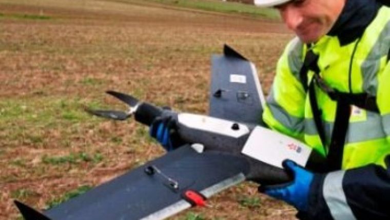
Removal of vegetation, debris and rubbish, installation of fencing, and road construction activities are currently underway (Figure 1). Planning and communicating such work and monitoring progress requires geodata to be collected on a weekly basis. An aerial survey, commissioned in late 2008, showed that the frequent cloud cover and high costs involved inhibit the routine use of conventional photogrammetry. A pilot project using a drone equipped with a consumer-grade digital camera demonstrated that UAS could be a feasible alternative, and gave insight into the UAS type required. Should it be a helicopter or an aeroplane?

Value staying current with geomatics?
Stay on the map with our expertly curated newsletters.
We provide educational insights, industry updates, and inspiring stories to help you learn, grow, and reach your full potential in your field. Don't miss out - subscribe today and ensure you're always informed, educated, and inspired.
Choose your newsletter(s)


