Geospatial Information: Fundamental to Global Sustainability and Development
Report on the Sixth Session of the United Nations Committee of Experts on Global Geospatial Information Management (UN-GGIM),
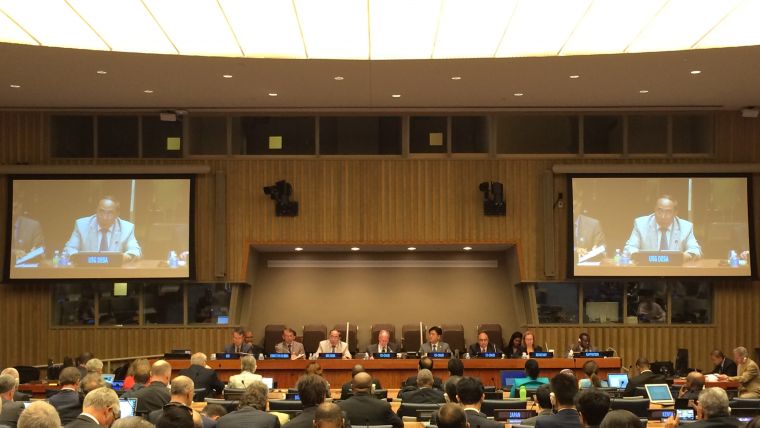
The significance of geospatial information’s contribution towards managing and sustaining our world was once again reaffirmed at the sixth session of the UN-GGIM Committee of Experts in New York, USA, from 3-5 August 2016. The 12 substantive decisions taken by national government delegations demonstrated this relevance and significance in sustainable development globally, regionally and nationally. The sixth session was attended by over 310 participants representing 93 Member States and a host of intergovernmental and international organisations, the academic and private sectors, as well as civil societies.
(By Greg Scott, Inter-Regional Advisor, UN-GGIM)
In its short history – from 2011 to the present day – the Committee of Experts, with the support of many national to global geospatial partners, has sought to raise awareness and understanding that geospatial data, information technologies, platforms and services have become critical tools to support national development, economic growth, improved evidence-based decision-making and policy formulation. These new capabilities have enhanced the ability for governments, international organisations and researchers to analyse, model, monitor and report on challenges related to humanitarian, peace and security, sustainable development, climate change, disaster and other development issues, at scales ranging from local to global.
ECOSOC
The sixth session was set against a backdrop of an important signal issued by the United Nations Economic and Social Council (ECOSOC) the previous week. On 27 July, and following a five-year review of UN-GGIM’s work and operations, ECOSOC adopted resolution 2016/27 entitled ‘Strengthening the institutional arrangements on geospatial information management’. ECOSOC acknowledged the considerable achievements of UN-GGIM in its first five years, including the establishment of a strong and streamlined regional infrastructure that reports to the Committee of Experts. It also recognised the role of UN-GGIM in the implementation of the 2030 Agenda for Sustainable Development, the Sendai Framework for Disaster Risk Reduction 2015-2030, the Paris Agreement on Climate Change, and the SAMOA Pathway, and that the Committee is well placed to continue to contribute to the work of the United Nations.
Valuable role
In his opening address, Mr Wu Hongbo, United Nations Under-Secretary-General for Economic and Social Affairs, underscored this relevance and significance when he noted that “the 2030 Agenda addresses the need for new data acquisition and integration approaches to improve the availability, quality, timeliness and disaggregation of data to support implementation at all levels. This includes a wide range of data, including Earth observations and geospatial information. As a consequence, this Committee of Experts has a valuable role to play”.
Highlights
Highlights of the sixth session included: unanimous recognition of the new and strengthened mandate provided to UN-GGIM by ECOSOC’s resolution 2016/27 and the accompanying responsibilities; the strong support for the creation of an ‘academic network’ and a ‘private-sector network’ that further reinforces the Committee’s existing architecture; the adoption of five guiding principles as the foundation of the Global Statistical Geospatial Framework in acknowledgement that the 2030 Agenda and the 2020 Round of Censuses are important drivers for the integration of geospatial and statistical information; the continued preparation of the Strategic Framework on Geospatial Information and Services for Disasters 2016-2030 in response to the Sendai Framework; advanced preparations towards a draft minimum list of fundamental geospatial data themes; endorsement of the road map for the global geodetic reference frame and elevation of the Working Group on the Global Geodetic Reference Frame to a UN-GGIM Sub-Committee on Geodesy, to provide the required stability and longer-term planning for the global geodetic reference frame; and an enhanced mandate to enable geospatial information and Earth observations to contribute to the global set of indicators for the Sustainable Development Goals (SDGs) through a new Working Group on Geospatial Information under the Inter-agency and Expert Group on SDG Indicators (IAEG-SDGs) of the Statistical Commission.

Value staying current with geomatics?
Stay on the map with our expertly curated newsletters.
We provide educational insights, industry updates, and inspiring stories to help you learn, grow, and reach your full potential in your field. Don't miss out - subscribe today and ensure you're always informed, educated, and inspired.
Choose your newsletter(s)


